Toggle navigation
LMEC Home
Exhibitions
Georeferencing
Tools for Teachers
Collections
My Favorites
Sign Up / Log In
Search
Search the map portal
Map Collection
Map Collection
Map Sets
Search
Search
Search for
Search In
All Fields
Creator
Title
Subject
Place
Search All Digital Collections
Advanced Search
13596 Results
Filter your Search
Place
North and Central America
10,262
United States
8,393
Massachusetts
2,784
Suffolk (county)
1,677
Boston
1,633
Europe
1,413
Canada
950
New York
646
more
Place
»
Topic
Boston (Mass.)--Maps
747
City planning--Massachusetts--Boston--Maps
418
United States--History--Revolution, 1775-1783--Maps
329
United States--Maps
321
Real property--Massachusetts--Boston--Maps
254
Urban renewal--Massachusetts--Boston--Maps
254
Massachusetts--Maps
231
Insurance surveys
197
more
Topic
»
Date
Date range begin
–
Date range end
Current results range from
1482
to
2023
View distribution
Creator
United States. Hydrographic Office
597
Boston Redevelopment Authority
404
Des Barres, Joseph F. W. (Joseph Frederick Wallet), 1722-1824
247
Royal United Services Institute for Defence and Security Studies
160
Jefferys, Thomas, -1771
154
George, III, King of Great Britain, 1738-1820
152
George, IV, King of Great Britain, 1762-1830
151
O.H. Bailey & Co
148
more
Creator
»
Format
Maps/Atlases
13,415
Manuscripts
985
Prints
102
Books
49
Drawings/Illustrations
44
Photographs
15
Objects/Artifacts
13
Documents
7
more
Format
»
Georeferenced
Yes
979
No
12,617
Collection
Norman B. Leventhal Map & Education Center Collection
9,088
American Revolutionary War-Era Maps
3,305
Boston and New England Maps
2,906
Urban Maps
2,465
Maritime Charts and Atlases
1,169
William L. Clements Library Collection
910
Library of Congress Collection
618
Boston Redevelopment Authority Collection
475
more
Collection
»
Available to use
No known restrictions
10,163
Creative Commons license
1,677
Search Constraints
Sort by relevance
relevance
title
date (asc)
date (desc)
Number of results to display per page
20 per page
10
per page
20
per page
50
per page
100
per page
View results as:
grid view
map view
Search Results
2901.
Diagram of rail roads diverging from Boston : showing the depots and distances
2902.
Diagram of the Battle of Ball's Bluff
2903.
A diagram of the triangulation for the survey of the coast of the United States, made in 1817 and 1833, and the secondary...
2904.
Diagram of the United States of America, Mexico, the West India Islands and Isthmus of Darien : showing proposed routes of the...
2905.
Diagram showing the Changuinola Railroad lines
2906.
Diagram to illustrate contrast between British and Chinese Empires
2907.
A diagrammatic road map of Central Europe : for the use of automobilists and cyclists
2908.
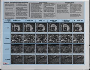
Digital orthography checkplots : a comparison of digital imagery resolution and file format
2909.
Dinsmore's complete map of the railroads & canals in the United States & Canada
2910.
Dinsmore's complete map of the railroads & canals in the United States & Canada
2911.
Dinsmore's new railroad map of the United States and the Canadas, showing all the railroads completed and in progress,...
2912.
Diocèse de Castres, dédié à Messire Augustin de Maupeou, Conseiller du Roy en ses Conseils Evêque de Castres
2913.
Diocese de l'archevesche de Bourges
2914.
Diocese de l'archevesché de Tours : La Touraine : Les Eslections de Tours, d'Amboise, de Loches, et de Chinon
2915.
Diocese de Lavaur descrit par ordre de Monseigneur l'illustrissime et reverendissime Charles Le Goux de Laberchere Evesque de...
2916.
Le Diocese de Limoges : divisé en ses dix huict Archipretré et les Gouvernemens de la Marche et du Limosin dans les quels il...
2917.
Diocese de Nismes
2918.
Le Diocese de Toulouse
2919.
Diocese du Mans divisee par doyennes ruraux
2920.
Diocese, prevoste, et eslection de Paris : le diocese est divisé en archipretrés, ou doyennés ruraux, la prevosté en...
‹ Prev
Next ›
1
2
…
142
143
144
145
146
147
148
149
150
…
679
680