Digital orthography checkplots : a comparison of digital imagery resolution and file format
Item Information
- Title:
- Digital orthography checkplots : a comparison of digital imagery resolution and file format
- Creator:
- MassGIS (Office : Mass.)
- Name on Item:
-
MassGIS
- Date:
-
2000
- Format:
-
Maps/Atlases
- Genre:
-
Remote-sensing images
- Location:
-
Boston Public Library
Norman B. Leventhal Map & Education Center - Collection (local):
-
Applied Geographics, Inc. Records
- Subjects:
-
Boston (Mass.)--Remote-sensing images
Resolution (Optics)
Imaging systems--Image quality
Aerial photography in geography
- Places:
-
MassachusettsSuffolk (county)Boston
- Extent:
- 24 remote-sensing images on 1 sheet ; 12 x 15 cm on sheet 92 x 118 cm
- Terms of Use:
-
No known copyright restrictions.
No known restrictions on use.
- Publisher:
-
Massachusetts :
MassGIS
- Scale:
-
Scales differ
- Language:
-
English
- Notes:
-
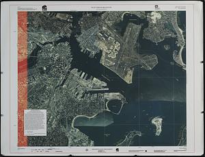
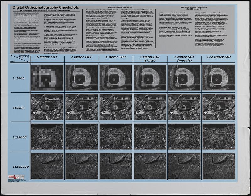
Comparison grid of aerial of photos of Boston zooming in to Fenway Park at different scales, resolutions and image types.
Includes explanatory text.
- Identifier:
-
06_01_019061
- Call #:
-
AppGeo Folder 31 no. 1
- Barcode:
-
30000008064329