Toggle navigation
LMEC Home
Exhibitions
Georeferencing
Tools for Teachers
Collections
My Favorites
Sign Up / Log In
Search
Search the map portal
Map Collection
Map Collection
Map Sets
Search
Search
Search for
Search In
All Fields
Creator
Title
Subject
Place
Search All Digital Collections
Advanced Search
5279 Results
My Search
Start Over
Date Range
before 1800
Remove constraint Date Range: before 1800
Filter your Search
Place
North and Central America
3,489
United States
2,248
Canada
655
Europe
506
Massachusetts
367
New York
355
North America
307
Suffolk (county)
203
more
Place
»
Topic
United States--History--Revolution, 1775-1783--Maps
323
North America--Maps--Early works to 1800
179
United States--History--French and Indian War, 1754-1763--Maps
161
Manuscript maps--Early works to 1800
137
New England--Maps--Early works to 1800
89
World maps--Early works to 1800
76
America--Maps--Early works to 1800
73
Saint Lawrence River--Maps
63
more
Topic
»
Date
Date range begin
–
Date range end
Current results range from
1482
to
1990
View distribution
Creator
Des Barres, Joseph F. W. (Joseph Frederick Wallet), 1722-1824
245
Royal United Services Institute for Defence and Security Studies
158
Jefferys, Thomas, -1771
153
George, III, King of Great Britain, 1738-1820
152
George, IV, King of Great Britain, 1762-1830
151
Amherst, Jeffery Amherst, Baron, 1717-1797
130
Sayer, Robert, 1725-1794
107
Faden, William, 1749-1836
106
more
Creator
»
Format
Maps/Atlases
5,166
Manuscripts
787
Prints
59
Drawings/Illustrations
36
Books
11
Documents
5
Objects/Artifacts
3
Ephemera
1
Georeferenced
Yes
156
No
5,123
Collection
American Revolutionary War-Era Maps
3,277
Norman B. Leventhal Map Center Collection
2,089
William L. Clements Library Collection
905
Library of Congress Collection
618
Town plans, 1794
403
British Library Collection
375
Maritime Charts and Atlases
371
Richard H. Brown Revolutionary War Map Collection at Mount Vernon
294
more
Collection
»
Available to use
No known restrictions
2,467
Creative Commons license
1,559
Search Constraints
Sort by relevance
relevance
title
date (asc)
date (desc)
Number of results to display per page
20 per page
10
per page
20
per page
50
per page
100
per page
View results as:
grid view
map view
Search Results
5241.
West-Indische paskaert : waer in de graden der breedde over weder zyden vande middellyn wassende soo vergroten dat die...
5242.
White Haven
5243.
White Haven
5244.
White Haven
5245.
White Haven
5246.
White Haven
5247.
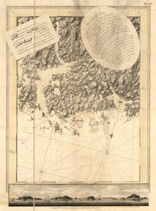
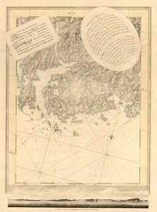
White Islands Harbour : Port Stephen's ; Liscomb Harbour ; Houlton Harbour ; River St. Mary
5248.
White Islands Harbour ; Port Stephen's ; Liscomb Harbour ; Houlton Harbour ; River St. Mary
5249.
White Islands Harbour ; Port Stephen's ; Liscomb Harbour ; Houlton Harbour ; River St. Mary
5250.
White Islands Harbour ; Port Stephen's ; Liscomb Harbour ; Houlton Harbour ; River St. Mary
5251.
White Plains
5252.
Wigorniensis comitatus cum Warwicensi, nec non Conventriae Libertas
5253.
Williamsburgh & the slip of land between York & James rivers from thence to Hampton
5254.
Wiltonia sive comitatus Wiltoniensis : Anglis Wil Shire
5255.
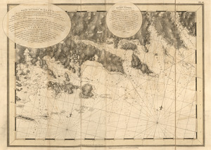
The Windward passage from Jamaica, betwene the east end of Cuba, and the west end of Hispaniola
5256.
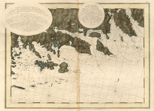
The Windward Passage, with the several passages from the east end of Cuba : & from the north part of St. Domingo
5257.
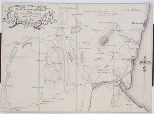
The Winter-Cantonment of the American Army and it's Vicinity for 1783
5258.
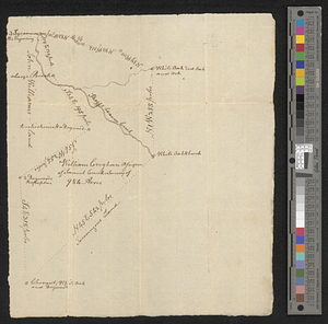
Wm. Croghans 984 acres on Skeggs beaver creek
5259.
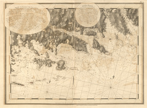
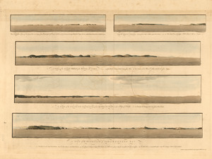
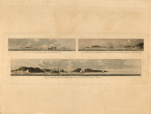
The Wolves, a cluster of isles lying s.e. near 3 leagues from Pasamaquady Bay ... ; Grand Manan Island ... ; A view of the...
5260.
The Wolves, (a cluster of isles) lying s.e. off the entrance of Passamaquadi Bay ; Grand Manan Island ... ; View of the shore...
‹ Prev
Next ›
1
2
…
259
260
261
262
263
264