Toggle navigation
LMEC Home
Exhibitions
Georeferencing
Tools for Teachers
Collections
My Favorites
Sign Up / Log In
Search
Search the map portal
Map Collection
Map Collection
Map Sets
Search
Search
Search for
Search In
All Fields
Creator
Title
Subject
Place
Search All Digital Collections
Advanced Search
10951 Results
My Search
Start Over
All Fields
americas
Remove constraint All Fields: americas
Filter your Search
Place
North and Central America
10,344
United States
8,469
Massachusetts
2,789
Suffolk (county)
1,675
Boston
1,631
Canada
937
New York
649
Middlesex (county)
441
more
Place
»
Topic
Boston (Mass.)--Maps
746
City planning--Massachusetts--Boston--Maps
418
United States--History--Revolution, 1775-1783--Maps
327
United States--Maps
320
Real property--Massachusetts--Boston--Maps
254
Urban renewal--Massachusetts--Boston--Maps
254
Massachusetts--Maps
231
Insurance surveys
194
more
Topic
»
Date
Date range begin
–
Date range end
Current results range from
1507
to
2023
View distribution
Creator
Boston Redevelopment Authority
404
United States. Hydrographic Office
366
Des Barres, Joseph F. W. (Joseph Frederick Wallet), 1722-1824
197
Jefferys, Thomas, -1771
150
George, III, King of Great Britain, 1738-1820
146
O.H. Bailey & Co
146
George, IV, King of Great Britain, 1762-1830
145
Royal United Services Institute for Defence and Security Studies
139
more
Creator
»
Format
Maps/Atlases
10,828
Manuscripts
916
Prints
60
Books
43
Drawings/Illustrations
43
Photographs
15
Objects/Artifacts
7
Posters
3
more
Format
»
Georeferenced
Yes
823
No
10,128
Collection
Norman B. Leventhal Map & Education Center Collection
6,627
American Revolutionary War-Era Maps
3,123
Boston and New England Maps
2,912
Urban Maps
2,289
William L. Clements Library Collection
892
Maritime Charts and Atlases
816
Library of Congress Collection
552
Boston Redevelopment Authority Collection
475
more
Collection
»
Available to use
No known restrictions
7,767
Creative Commons license
1,541
Search Constraints
Sort by relevance
relevance
title
date (asc)
date (desc)
Number of results to display per page
20 per page
10
per page
20
per page
50
per page
100
per page
View results as:
grid view
map view
Search Results
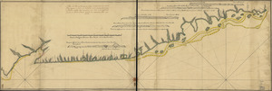
1861.
Costa de Cuba desde Cabo de San Antonio a la bahía de Cardenas
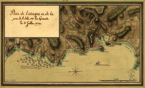
1862.
Plan de l'attaque et de la prise de l'isle de la Grenade le 3 juillet 1779
1863.
A plan of the Rosalij Compy. Estates showing the impracticable lands
1864.
Plano de la hermosa Bahía de Naranjos situada en la costa del norte de la ysla de Sn. Tiago de Cuva
1865.
Plano del puertecito de la Chorrera cituado una legua al O. de la Havana
1866.
Plano del puertecito de la Chorrera situado una legua al O. de la Havana
1867.
Plano del Puerto de Samá, situado en la costa del N. de la ysla de Sntiágo. de Cuba
1868.
A Sketch of the harbour of St. Iago de Cuba
1869.
A mapp of Virginia discouered to ye hills, and in its latt: from 35 deg: & 1/2 neer Florida, to 41 deg: bounds of new England
1870.
Rhode Island
1871.
Atlantic Ocean
1872.
Walling and Gray's map of the United States and territories
1873.
Dinsmore's complete map of the railroads & canals in the United States & Canada
1874.
New England : die mercklichsten dheile, also genennet durch den durchl: und mechtigen Prinzen und h.h. Carolus, Prinzen von...
1875.
Pas-caert van Nieu Nederland, Virginia, Nieu Engeland als mede Penn-silvania, met de stad Philadelfia van Baston tot Carrik = a...
1876.
Map showing Caribbean area including West Indies and Gulf of Mexico
1877.
A map of South Carolina and a part of Georgia : containing the whole sea-coast; all the islands, inlets, rivers, creeks,...
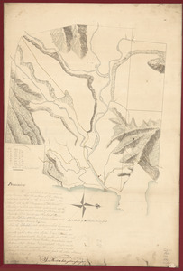
1878.
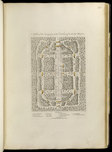
A plan of the encampment of the detachment from the little Meadows
1879.
Remarks
1880.
Carte des Etats-Unis d'Amérique, et du cours du Mississippi : rédigée d'après différentes cartes et relations Anglaises et...
‹ Prev
Next ›
1
2
…
90
91
92
93
94
95
96
97
98
…
547
548