Toggle navigation
LMEC Home
Exhibitions
Georeferencing
Tools for Teachers
Collections
My Favorites
Sign Up / Log In
Search
Search the map portal
Map Collection
Map Collection
Map Sets
Search
Search
Search for
Search In
All Fields
Creator
Title
Subject
Place
Search All Digital Collections
Advanced Search
10836 Results
My Search
Start Over
All Fields
americas
Remove constraint All Fields: americas
Filter your Search
Place
North and Central America
10,232
United States
8,361
Massachusetts
2,778
Suffolk (county)
1,673
Boston
1,629
Canada
936
New York
640
Middlesex (county)
438
more
Place
»
Topic
Boston (Mass.)--Maps
745
City planning--Massachusetts--Boston--Maps
418
United States--History--Revolution, 1775-1783--Maps
327
United States--Maps
319
Real property--Massachusetts--Boston--Maps
254
Urban renewal--Massachusetts--Boston--Maps
254
Massachusetts--Maps
230
Insurance surveys
194
more
Topic
»
Date
Date range begin
–
Date range end
Current results range from
1507
to
2023
View distribution
Creator
Boston Redevelopment Authority
404
United States. Hydrographic Office
365
Des Barres, Joseph F. W. (Joseph Frederick Wallet), 1722-1824
197
Jefferys, Thomas, -1771
150
George, III, King of Great Britain, 1738-1820
146
O.H. Bailey & Co
146
George, IV, King of Great Britain, 1762-1830
145
Royal United Services Institute for Defence and Security Studies
139
more
Creator
»
Format
Maps/Atlases
10,713
Manuscripts
916
Prints
60
Books
43
Drawings/Illustrations
43
Photographs
15
Objects/Artifacts
7
Posters
3
more
Format
»
Georeferenced
Yes
823
No
10,013
Collection
Norman B. Leventhal Map & Education Center Collection
6,600
American Revolutionary War-Era Maps
3,123
Boston and New England Maps
2,897
Urban Maps
2,277
William L. Clements Library Collection
892
Maritime Charts and Atlases
814
Library of Congress Collection
552
Boston Redevelopment Authority Collection
475
more
Collection
»
Available to use
No known restrictions
7,653
Creative Commons license
1,540
Search Constraints
Sort by relevance
relevance
title
date (asc)
date (desc)
Number of results to display per page
20 per page
10
per page
20
per page
50
per page
100
per page
View results as:
grid view
map view
Search Results
141.
Canada orientale nell' America Settentrionale
142.
A new chart of America : with the harbors, of Port Royal and Savannah &c
143.
South America, west coast--Patagonia
144.
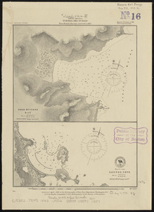
South America, Tierra del Fuego : from British surveys corrected to 1877
145.
The United States of America : laid down from the best authorities agreeable to the peace of 1783. : This map and chart is...
146.
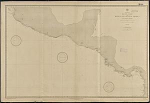
North America, Pacific coast of Mexico and Central America, San Blas to Panama : compiled from the latest British and United...
147.
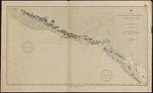
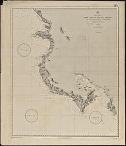
North America, west coast of Central America, Ocos River to San Juan del Sur
148.
North America, west coast of Central America, San Juan del Sur to Judas Point
149.
A pictorial map of North America
150.
Americae siue noui orbis, noua descriptio
151.
Americae siue noui orbis, noua descriptio
152.
Noua et accurata totius Americae tabula
153.
Americae siue noui orbis, noua descriptio
154.
Americae siue noui orbis, noua descriptio
155.
The pictorial map, stamps of America
156.
Americae siue noui orbis, noua descriptio
157.
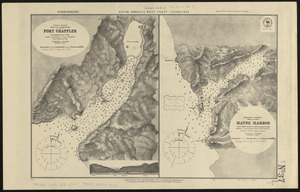
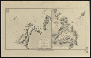
South America, west coast, Port Barbara : from a British survey corrected to 1877 ; South America, west coast, Port Otway in...
158.
A General map of North America
159.
A general map of North America
160.
An accurate map of North America
‹ Prev
Next ›
1
2
…
4
5
6
7
8
9
10
11
12
…
541
542