Toggle navigation
LMEC Home
Exhibitions
Georeferencing
Tools for Teachers
Collections
My Favorites
Sign Up / Log In
Search
Search the map portal
Map Collection
Map Collection
Map Sets
Search
Search
Search for
Search In
All Fields
Creator
Title
Subject
Place
Search All Digital Collections
Advanced Search
10961 Results
My Search
Start Over
All Fields
americas
Remove constraint All Fields: americas
Filter your Search
Place
North and Central America
10,354
United States
8,478
Massachusetts
2,796
Suffolk (county)
1,676
Boston
1,632
Canada
937
New York
650
Middlesex (county)
441
more
Place
»
Topic
Boston (Mass.)--Maps
747
City planning--Massachusetts--Boston--Maps
418
United States--History--Revolution, 1775-1783--Maps
327
United States--Maps
320
Real property--Massachusetts--Boston--Maps
254
Urban renewal--Massachusetts--Boston--Maps
254
Massachusetts--Maps
233
Insurance surveys
194
more
Topic
»
Date
Date range begin
–
Date range end
Current results range from
1507
to
2023
View distribution
Creator
Boston Redevelopment Authority
404
United States. Hydrographic Office
366
Des Barres, Joseph F. W. (Joseph Frederick Wallet), 1722-1824
197
Jefferys, Thomas, -1771
150
George, III, King of Great Britain, 1738-1820
146
O.H. Bailey & Co
146
George, IV, King of Great Britain, 1762-1830
145
Royal United Services Institute for Defence and Security Studies
139
more
Creator
»
Format
Maps/Atlases
10,838
Manuscripts
916
Prints
60
Books
43
Drawings/Illustrations
43
Photographs
15
Objects/Artifacts
7
Posters
3
more
Format
»
Georeferenced
Yes
823
No
10,138
Collection
Norman B. Leventhal Map & Education Center Collection
6,635
American Revolutionary War-Era Maps
3,123
Boston and New England Maps
2,918
Urban Maps
2,294
William L. Clements Library Collection
892
Maritime Charts and Atlases
816
Library of Congress Collection
552
Boston Redevelopment Authority Collection
475
more
Collection
»
Available to use
No known restrictions
7,777
Creative Commons license
1,541
Search Constraints
Sort by relevance
relevance
title
date (asc)
date (desc)
Number of results to display per page
20 per page
10
per page
20
per page
50
per page
100
per page
View results as:
grid view
map view
Search Results
10841.
Map of the Canadian Rockies triangle tour of British Columbia, Alaska and the Yukon
10842.
Map of the cities of New York, Brooklyn & Jersey City
10843.
The Matthews-Northrup up-to-date map of Buffalo and towns of Tonawanda, Amherst, Cheektowaga and West Seneca
10844.
The Matthews-Northrup up-to-date map of Buffalo and Towns of Tonawanda, Amherst, Cheektowaga and West Seneca
10845.
Navajoland, U.S.A.
10846.
New York City map
10847.
Plan de la rivière du Cap Fear depuis la barre jusques à Brunswick
10848.
Plan from St. Marys to St. Johns
10849.
Plan of the river of St. Johns from Fort Frederick in the Bay of Fundy to the river of Medouesqua with the lake of Temescouata...
10850.
Post route map of the states of Pennsylvania, New Jersey, Delaware, and Maryland and of the District of Columbia with adjacent...
10851.
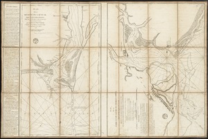
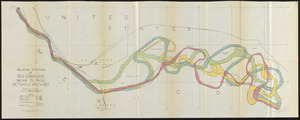
Relative positions of Rio Grande near El Paso between 1852 and 1907
10852.
Sketch of forts Clinton and Montgomery stormed the 6th October 1777 by the troops under the command of Sr. Henry Clinton K:B:...
10853.
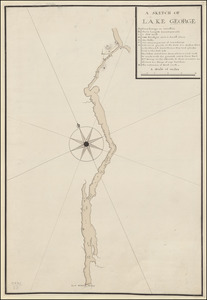
A SKETCH OF LAKE GEORGE
10854.
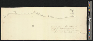
A sketch of the south shore of Lake Ontario between Oswego and Niagara, and from thence up the river to aboute two miles above...
10855.
West Indies, anchorages on the north coast of Cuba
10856.
Atlas of Dorchester, West Roxbury and Brighton, city of Boston
10857.
French draught of Lake Champlain & Lake George with remarks of an English prisoner who return'd from Quebec to Fort Edward by...
10858.
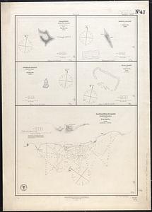
Gardner's or Kemins Island, Phœnix Group ; Flint's Island ; McKeans Island, Phœnix Group ; Maro Reef ; Lahaina Roads, Island of...
10859.
Map of New-York Bay and Harbor and the environs
10860.
Map of the battlefield of Bull Run, Virginia. Brig. Gen. Irvin McDowell commanding the U.S. forces, Gen. [P.] G.T. Beauregard...
‹ Prev
Next ›
1
2
…
539
540
541
542
543
544
545
546
547
548
549


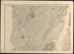
![Map of the battlefield of Bull Run, Virginia. Brig. Gen. Irvin McDowell commanding the U.S. forces, Gen. [P.] G.T. Beauregard commanding the Confederate forces, July 21st 1861](https://bpldcassets.blob.core.windows.net/derivatives/images/commonwealth:ww72bp023/image_thumbnail_300.jpg)