Toggle navigation
LMEC Home
Exhibitions
Georeferencing
Tools for Teachers
Collections
My Favorites
Sign Up / Log In
Search
Search the map portal
Map Collection
Map Collection
Map Sets
Search
Search
Search for
Search In
All Fields
Creator
Title
Subject
Place
Search All Digital Collections
Advanced Search
10961 Results
My Search
Start Over
All Fields
americas
Remove constraint All Fields: americas
Filter your Search
Place
North and Central America
10,354
United States
8,478
Massachusetts
2,796
Suffolk (county)
1,676
Boston
1,632
Canada
937
New York
650
Middlesex (county)
441
more
Place
»
Topic
Boston (Mass.)--Maps
747
City planning--Massachusetts--Boston--Maps
418
United States--History--Revolution, 1775-1783--Maps
327
United States--Maps
320
Real property--Massachusetts--Boston--Maps
254
Urban renewal--Massachusetts--Boston--Maps
254
Massachusetts--Maps
233
Insurance surveys
194
more
Topic
»
Date
Date range begin
–
Date range end
Current results range from
1507
to
2023
View distribution
Creator
Boston Redevelopment Authority
404
United States. Hydrographic Office
366
Des Barres, Joseph F. W. (Joseph Frederick Wallet), 1722-1824
197
Jefferys, Thomas, -1771
150
George, III, King of Great Britain, 1738-1820
146
O.H. Bailey & Co
146
George, IV, King of Great Britain, 1762-1830
145
Royal United Services Institute for Defence and Security Studies
139
more
Creator
»
Format
Maps/Atlases
10,838
Manuscripts
916
Prints
60
Books
43
Drawings/Illustrations
43
Photographs
15
Objects/Artifacts
7
Posters
3
more
Format
»
Georeferenced
Yes
823
No
10,138
Collection
Norman B. Leventhal Map & Education Center Collection
6,635
American Revolutionary War-Era Maps
3,123
Boston and New England Maps
2,918
Urban Maps
2,294
William L. Clements Library Collection
892
Maritime Charts and Atlases
816
Library of Congress Collection
552
Boston Redevelopment Authority Collection
475
more
Collection
»
Available to use
No known restrictions
7,777
Creative Commons license
1,541
Search Constraints
Sort by relevance
relevance
title
date (asc)
date (desc)
Number of results to display per page
20 per page
10
per page
20
per page
50
per page
100
per page
View results as:
grid view
map view
Search Results
10581.
Topographical map of Virginia between Washington and Manassas Junction
10582.
Topographical map of Westmoreland and Albert Counties : from actual surveys by D.J. Lake and H.S. Peck
10583.
Topographick plan by the eye, 1754 & 6
10584.
Township map of Bureau, Putnam, Stark, Marshall, Peoria, and Woodford Counties
10585.
Township map of Clay, Richland, Lawrence Wabash Edwards, and Wayne Counties
10586.
Township map of Union, Johnson, Pope, Alexander, Pulaski, and Massac Counties
10587.
Valley Forge, Pa. 1890
10588.
View of Sea Isle City : New Jersey
10589.
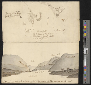
A view of the country towards Dorchester, taken from the advanced works on Boston Neck : Long Island open on the north side of...
10590.
Virginia, Maryland, Pennsilvania, east & west New Jarsey
10591.
Virginiae partis australis, et Floridae partis orientalis, interjacentiumq[ue] regionum nova descriptio
10592.
Virginiae partis australis et Floridae partis orientalis, interjacentium[que] regionum nova descriptio
10593.
Waterfront skyline
10594.
West Indies, Grenadines--Id. of Bequia, Admiralty Bay : from British surveys, corrected to 1872
10595.
West Indies, Little Bahama Bank, Whale Cay Channel and Green Turtle Cay anchorage : from a British survey in 1882-3
10596.
West Indies, north coast of Cuba, Bahia Honda : from a Spanish plan corrected to 1883 ; West Indies, north coast of Cuba, Port...
10597.
West Indies, north coast of Santo Domingo, Port Plata
10598.
West Indies--Bahama Islands, Inagua Island anchorages : from British surveys, corrected to 1873
10599.
West Lebanon, N.H., and White River Junction, Vermont
10600.
White Mountain National Forest : New Hampshire-Maine
‹ Prev
Next ›
1
2
…
526
527
528
529
530
531
532
533
534
…
548
549


![Virginiae partis australis, et Floridae partis orientalis, interjacentiumq[ue] regionum nova descriptio](https://bpldcassets.blob.core.windows.net/derivatives/images/commonwealth:st74cw930/image_thumbnail_300.jpg)
![Virginiae partis australis et Floridae partis orientalis, interjacentium[que] regionum nova descriptio](https://bpldcassets.blob.core.windows.net/derivatives/images/commonwealth:6t053p120/image_thumbnail_300.jpg)


