Topographical map of Westmoreland and Albert Counties : from actual surveys by D.J. Lake and H.S. Peck
Item Information
- Title:
- Topographical map of Westmoreland and Albert Counties : from actual surveys by D.J. Lake and H.S. Peck
- Cartographer:
- Walling, Henry Francis, 1825-1888
- Contributor:
- Lake, D. J.
- Contributor:
- Peck, H. S.
- Publisher:
- W.E. & A.A. Baker
- Name on Item:
-
drawn and engraved under the direction of H.F. Walling ; drawn, engraved, printed, colored and mounted at H.F. Wallings Map Establishment
- Date:
-
1862
- Format:
-
Maps/Atlases
- Location:
-
Boston Public Library
Norman B. Leventhal Map & Education Center - Collection (local):
-
Norman B. Leventhal Map & Education Center Collection
- Subjects:
-
Landowners--New Brunswick--Westmorland (County)--Maps
Landowners--New Brunswick--Albert (County)--Maps
Westmorland (N.B. : County)--Maps
Albert (N.B. : County)--Maps
- Places:
-
CanadaProvince of New Brunswick (province)
Westmorland County
Albert County
- Extent:
- 1 map ; 142 x 164 cm.
- Terms of Use:
-
No known copyright restrictions.
No known restrictions on use.
- Publisher:
-
New York :
W.E. & A.A. Baker
- Scale:
-
Scale 1:19,800
- Language:
-
English
- Notes:
-
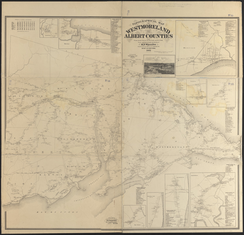
Oriented with north towards the upper left.
Also shows landowners.
Includes population statistics, business directories, ill. and 9 insets.
Insets: Lewisville -- Shediac -- Moncton -- Salisbury -- Dorchester -- Sackville -- Hillsborough -- Hopewell Cape -- Bay Verte.
- Identifier:
-
06_01_011670
- Call #:
-
G3433.W4 1862 .W35
- Barcode:
-
39999065687434


