Toggle navigation
LMEC Home
Exhibitions
Georeferencing
Tools for Teachers
Collections
My Favorites
Sign Up / Log In
Search
Search the map portal
Map Collection
Map Collection
Map Sets
Search
Search
Search for
Search In
All Fields
Creator
Title
Subject
Place
Search All Digital Collections
Advanced Search
10961 Results
My Search
Start Over
All Fields
americas
Remove constraint All Fields: americas
Filter your Search
Place
North and Central America
10,354
United States
8,478
Massachusetts
2,796
Suffolk (county)
1,676
Boston
1,632
Canada
937
New York
650
Middlesex (county)
441
more
Place
»
Topic
Boston (Mass.)--Maps
747
City planning--Massachusetts--Boston--Maps
418
United States--History--Revolution, 1775-1783--Maps
327
United States--Maps
320
Real property--Massachusetts--Boston--Maps
254
Urban renewal--Massachusetts--Boston--Maps
254
Massachusetts--Maps
233
Insurance surveys
194
more
Topic
»
Date
Date range begin
–
Date range end
Current results range from
1507
to
2023
View distribution
Creator
Boston Redevelopment Authority
404
United States. Hydrographic Office
366
Des Barres, Joseph F. W. (Joseph Frederick Wallet), 1722-1824
197
Jefferys, Thomas, -1771
150
George, III, King of Great Britain, 1738-1820
146
O.H. Bailey & Co
146
George, IV, King of Great Britain, 1762-1830
145
Royal United Services Institute for Defence and Security Studies
139
more
Creator
»
Format
Maps/Atlases
10,838
Manuscripts
916
Prints
60
Books
43
Drawings/Illustrations
43
Photographs
15
Objects/Artifacts
7
Posters
3
more
Format
»
Georeferenced
Yes
823
No
10,138
Collection
Norman B. Leventhal Map & Education Center Collection
6,635
American Revolutionary War-Era Maps
3,123
Boston and New England Maps
2,918
Urban Maps
2,294
William L. Clements Library Collection
892
Maritime Charts and Atlases
816
Library of Congress Collection
552
Boston Redevelopment Authority Collection
475
more
Collection
»
Available to use
No known restrictions
7,777
Creative Commons license
1,541
Search Constraints
Sort by relevance
relevance
title
date (asc)
date (desc)
Number of results to display per page
20 per page
10
per page
20
per page
50
per page
100
per page
View results as:
grid view
map view
Search Results
10481.
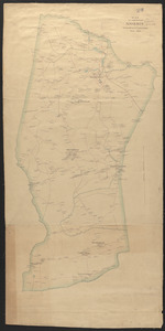
Map of the town of Morris : Morris County New Jersey
10482.
Map of Virginia and Maryland, constructed from the latest authorities
10483.
Map showing route of marches of the army of Genl. W.T. Sherman, from Atlanta, Ga. to Goldsboro, N.C : to accompany the report...
10484.
Metropolitan District Commission combined sewer overflow project Dorchester Bay area
10485.
Mount Auburn, avenues and paths
10486.
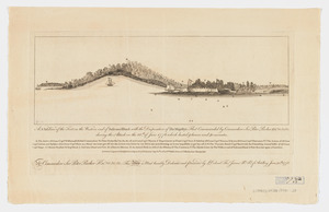
A N.b.E. view of the fort on the western end of Sulivans Island : with the disposition of His Majesty's fleet commanded by...
10487.
A new & complete map of the city of Boston, with part of Charlestown, Cambridge & Roxbury
10488.
A new & complete map of the city of Boston, with part of Charlestown, Cambridge & Roxbury
10489.
A new & complete map of the city of Boston, with part of Charlestown, Cambridge & Roxbury
10490.
A new and accurate map of Connecticut and Rhode Island from the best authorities
10491.
A new chart of ye coast of New Found Land, New Scotland and New England &c.
10492.
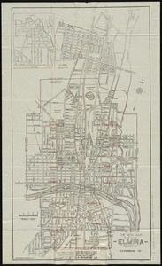
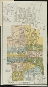
The new map of the City of Elmira
10493.
The new map of the City of Elmira
10494.
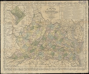
A new map of the state of Virginia : exhibiting its internal improvements, roads, distances, &c
10495.
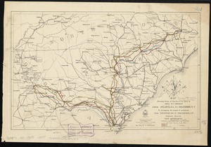
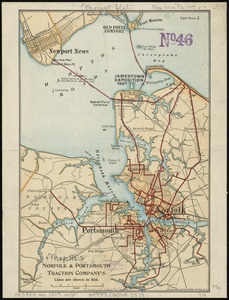
Norfolk & Portsmouth Traction Company's lines are shown in red
10496.
North end of Lake Michigan including Green Bay and the straits of Mackinac
10497.
Northeastern end of Long Island
10498.
Noui Belgii Nouaeque Angliae nec non partis Virginiae tabula
10499.
Novi Belgii Novaeqve Angliae nec non partis Virginiae Tabula
10500.
Ohio boundary no. 2 : map exhibiting the positions occupied on the Maumee Bay and river: viz: Turtle Island, the North Cape,...
‹ Prev
Next ›
1
2
…
521
522
523
524
525
526
527
528
529
…
548
549