Water resources of the Nashua River watershed
Item Information
- Title:
- Water resources of the Nashua River watershed
- Cartographer:
- Applied Geographics, Inc.
- Contributor:
- Massachusetts Bays Program
- Contributor:
- MassGIS (Office : Mass.)
- Contributor:
- Massachusetts. Executive Office of Environmental Affairs
- Date:
-
[1995]
- Format:
-
Maps/Atlases
- Location:
-
Boston Public Library
Norman B. Leventhal Map & Education Center - Collection (local):
-
Applied Geographics, Inc. Records
- Subjects:
-
Nashua River Watershed (Mass. and N.H.)--Maps
Wetlands--Nashua River Watershed (Mass. and N.H.)--Maps
Salt marshes--Nashua River Watershed (Mass. and N.H.)--Maps
Aquifers--Nashua River Watershed (Mass. and N.H.)--Maps
Wellhead protection--Nashua River Watershed (Mass. and N.H.)--Maps
Groundwater--Nashua River Watershed (Mass. and N.H.)--Maps
- Places:
-
MassachusettsNashua River
- Extent:
- 1 map : color ; 117 x 84 cm
- Terms of Use:
-
No known copyright restrictions.
No known restrictions on use.
- Publisher:
-
[Boston] :
[Applied Geographics, Inc.]
- Scale:
-
Scale 1:48,000
- Language:
-
English
- Notes:
-
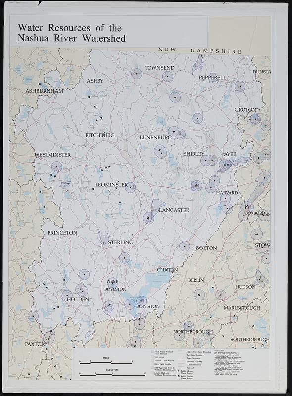
Shows wetlands, salt marshes, aquifers, wellhead protection areas and water sources.
A draft of a map produced for Massachusetts Bays Program, MassGIS and Massachusetts Executive Office of Environmental Affairs.
- Notes (date):
-
This date is inferred.
- Identifier:
-
06_01_018897
- Call #:
-
AppGeo Folder 1 no. 3
- Barcode:
-
30000008056328


