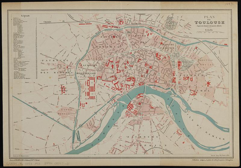
Plan de Toulouse d'apres les derniers documents officiels
Item Information
- Title:
- Plan de Toulouse d'apres les derniers documents officiels
- Engraver:
- Hausermann, R., active 1875-1915
- Publisher:
- Fayard et Fils
- Printer:
- Michel et Fils
- Name on Item:
-
gravé par R. Hausermann
- Date:
-
[1893?]
- Format:
-
Maps/Atlases
- Location:
-
Boston Public Library
Norman B. Leventhal Map & Education Center - Collection (local):
-
Norman B. Leventhal Map & Education Center Collection
- Subjects:
-
Toulouse (France)--Maps
- Places:
-
FranceOccitanie (region)Toulouse
- Extent:
- 1 map : color ; 26 x 40 cm
- Terms of Use:
-
No known copyright restrictions.
No known restrictions on use.
- Publisher:
-
Paris :
A. Fayard & Fils; Imp. Michel & Fils
- Scale:
-
Scale approximately 1:13,500
- Language:
-
French
- Notes:
-
Oriented with north to the upper left.
Includes key to places of interest.
In lower right: Collection unique, 250 plans de villes françaises et étrangères.
- Identifier:
-
06_01_019147
- Call #:
-
G5834.T6 1893 .P53
- Barcode:
-
39999085971131


