Nantucket coastal high hazard area mapping project
Item Information
- Title:
- Nantucket coastal high hazard area mapping project
- Publisher:
- Massachusetts Coastal Zone Management Office
- Cartographer:
- Applied Geographics, Inc.
- Funder:
- United States. Office of Ocean and Coastal Resource Management
- Funder:
- United States. Army. Corps of Engineers. New England District
- Name on Item:
-
Massachusetts Coastal Zone Management
- Date:
-
[ca. 1995]
- Format:
-
Maps/Atlases
- Genre:
-
Remote-sensing maps
- Location:
-
Boston Public Library
Norman B. Leventhal Map & Education Center - Collection (local):
-
Applied Geographics, Inc. Records
- Subjects:
-
Nantucket (Mass.)--Remote-sensing images
Coast changes--Massachusetts--Nantucket--Remote-sensing images
Coast changes--Massachusetts--Nantucket--Maps
Beach erosion--Massachusetts--Nantucket--Remote-sensing images
Beach erosion--Massachusetts--Nantucket--Maps
- Places:
-
MassachusettsNantucket (county)Nantucket Island (island)Nantucket
- Extent:
- 4 remote-sensing maps : color ; 100 x 80 cm, on sheets 118 x 92 cm
- Terms of Use:
-
No known copyright restrictions.
No known restrictions on use.
- Publisher:
-
Boston, Massachusetts :
Massachusetts Coastal Zone Management ; Applied Geographics, Inc.
- Scale:
-
Scale 1:10,000
- Language:
-
English
- Table of Contents:
-
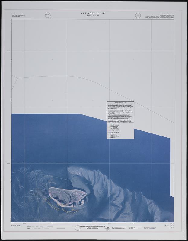
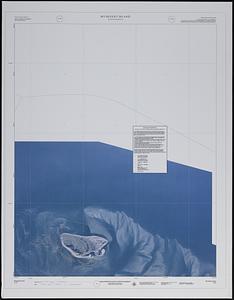
C-82 Muskeget Island
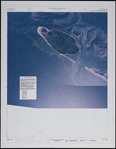
C-88 Tuckernuck Island
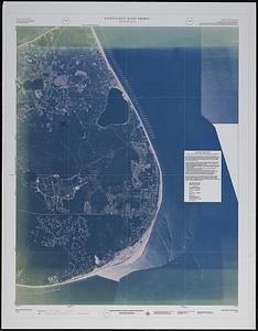
C-89 Nantucket (west)
C-91 Nantucket (east shore).
- Notes:
-
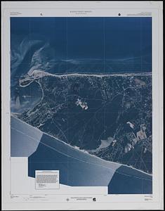
Shows coastal barriers, flood plain, shoreline change transects with average annual erosion rate, and town boundaries overlayed on a satellite images.
Includes text about Massachusetts coastal high hazard area mapping project.
"Partial funding provided and published by Army Corps of Engineers, New England District."
"Published for and partial funding provided by the U.S. Department of Commerce, National Oceanic and Atmospheric Administration, Office of Ocean and Coastal Resource Management."
"Date of aerial photography: September and October, 1994."
- Identifier:
-
06_01_018907
06_01_018997
- Call #:
-
AppGeo Folder 1 no. 14-16
AppGeo Folder 5 no. 23
- Barcode:
-
30000008056454
30000008056454x


