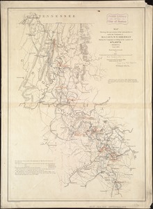
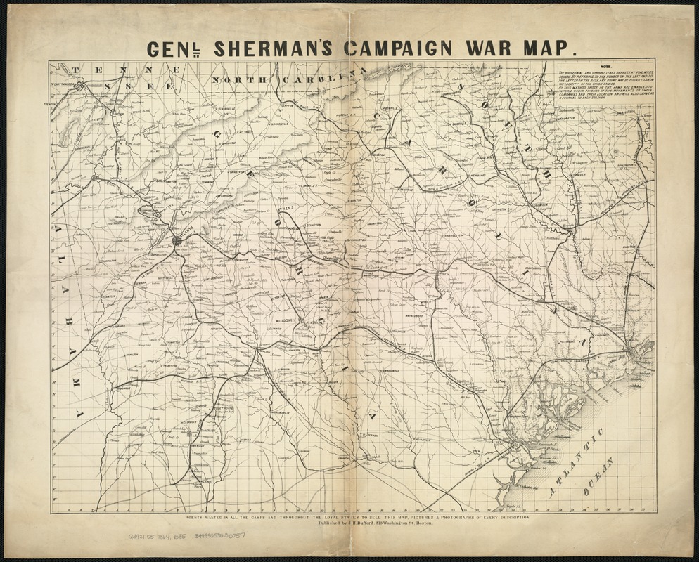
Genl. Sherman's campaign war map
Item Information
- Title:
- Genl. Sherman's campaign war map
- Description:
-
Map covering most of Georgia and South Carolina, showing defenses along the sea coast and around the principal towns, Confederate prisons at Andersonville and south of Millen, Ga., roads, railroads, towns, drainage, and relief by hachures.
- Creator:
- Bufford, John Henry, 1810-1870
- Date:
-
[1864]
- Format:
-
Maps/Atlases
- Location:
-
Boston Public Library
Norman B. Leventhal Map & Education Center - Collection (local):
-
Norman B. Leventhal Map & Education Center Collection
- Subjects:
-
Georgia--History--Civil War, 1861-1865--Campaigns--Maps
South Carolina--History--Civil War, 1861-1865--Campaigns--Maps
- Places:
-
Georgia
South Carolina
- Extent:
- 1 map ; 46 x 61 cm.
- Terms of Use:
-
No known copyright restrictions.
No known restrictions on use.
- Publisher:
-
Boston :
J.H. Bufford
- Scale:
-
Scale ca. 1:670,000.
- Language:
-
English
- Notes:
-
The horizontal and upright lines [of the map grid] represent five miles square. By referring [sic] to the number on the left and to the letter on the base, any point may be found to show the locality of the Union armies.
Description derived from published bibliography.
- Notes (date):
-
This date is inferred.
- Identifier:
-
06_01_007376
- Call #:
-
G3921.S5 1864 .B85
- Barcode:
-
39999059030757