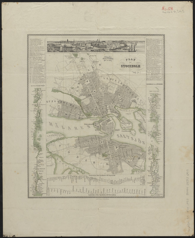
Plan af Stockholm
Item Information
- Title:
- Plan af Stockholm
- Title (alt.):
-
Jllustrerad plan af Stockholm jemte kartor öfver Stockholms omgifningar Mälaren kanalen till Götheborg resrouter genom Sverige och tretton pittoreska vyer från hufvudstaden och dess nejder
- Publisher:
- Bonnier, Albert
- Date:
-
[1870?–1879?]
- Format:
-
Maps/Atlases
- Location:
-
Boston Public Library
Norman B. Leventhal Map & Education Center - Collection (local):
-
Norman B. Leventhal Map & Education Center Collection
- Subjects:
-
Stockholm (Sweden)--Maps
- Places:
-
SwedenStockholm (county)Stockholm
- Extent:
- 1 map : color ; 37 x 31 cm, folded to 22 x 11 cm
- Terms of Use:
-
No known copyright restrictions.
No known restrictions on use.
- Publisher:
-
Stockholm :
Alb. Bonnier
- Scale:
-
Scale approximately 1:18,500
- Language:
-
Swedish
- Notes:
-
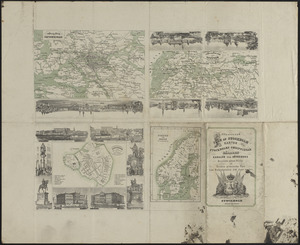
Includes index, panoramic view, 2 route maps and map of Kanalvägen från Stockholm till Götheborg [in 2 parts].
Illustrations and 4 maps on verso.
- Identifier:
-
06_01_015169
06_01_016670
- Call #:
-
G6954.S7 1870 .P53
- Barcode:
-
39999085932919


