Map of Boston boundary line changes
Item Information
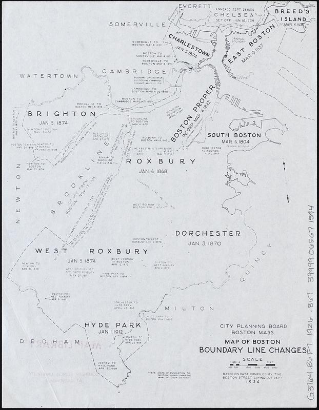
- Title:
- Map of Boston boundary line changes
- Cartographer:
- Boston (Mass.). City Planning Board
- Name on Item:
-
City Planning Board, Boston Mass.
- Date:
-
1926
- Format:
-
Maps/Atlases
- Location:
-
Boston Public Library
Norman B. Leventhal Map & Education Center - Collection (local):
-
Norman B. Leventhal Map & Education Center Collection
- Subjects:
-
Boston (Mass.)--Boundaries--Maps
Boston (Mass.)--Administrative and political divisions--Maps
Annexation (Municipal government)--Massachusetts--Boston--Maps
- Places:
-
MassachusettsSuffolk (county)Boston
- Extent:
- 1 map ; 28 x 22 cm
- Terms of Use:
-
No known copyright restrictions.
No known restrictions on use.
- Publisher:
-
[Boston :
City Planning Board
- Scale:
-
Scale approximately 1:60,000
- Language:
-
English
- Notes:
-
Includes dates of districts' annexation to Boston.
"Based on data compiled by the Boston Street Laying-Out Dept."
- Identifier:
-
06_01_017920
- Call #:
-
G3764.B6F7 1926 .B67
- Barcode:
-
39999065671594


