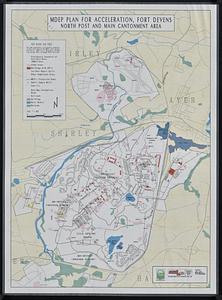
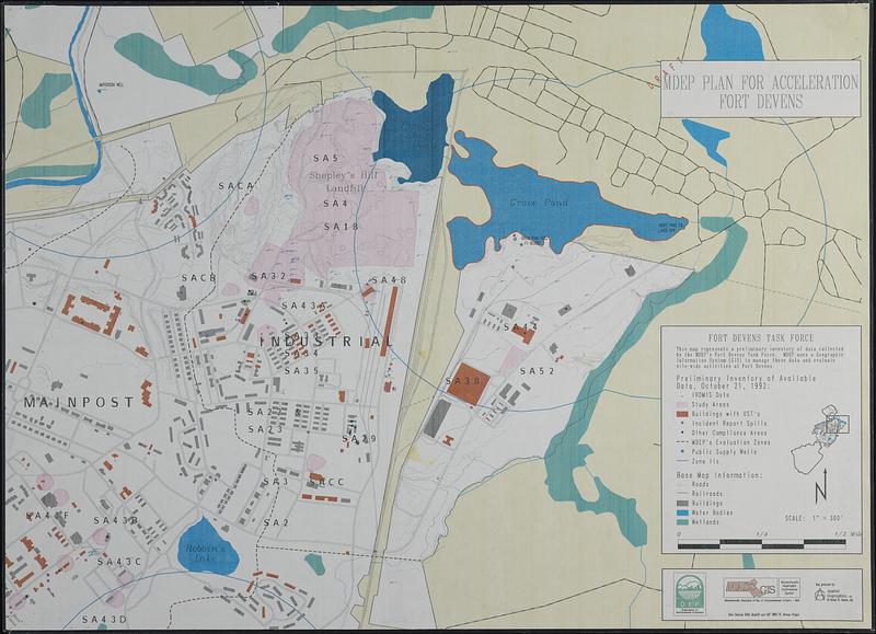
MDEP plan for acceleration Fort Devens
Item Information
- Title:
- MDEP plan for acceleration Fort Devens
- Cartographer:
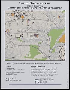
- Applied Geographics, Inc.
- Contributor:
- Massachusetts. Department of Environmental Protection
- Contributor:
- MassGIS (Office : Mass.)
- Contributor:
- Massachusetts. Executive Office of Environmental Affairs
- Name on Item:
-
map produced by Applied Geographics, Inc. ; Department of Environmental Protection ; Massachusetts Geographic Information System ; Massachusetts Executive Office of Environmental Affairs
- Date:
-
1992
- Format:
-
Maps/Atlases
- Location:
-
Boston Public Library
Norman B. Leventhal Map & Education Center - Collection (local):
-
Applied Geographics, Inc. Records
- Subjects:
-
Fort Devens (Mass.)--Maps
Environmental protection--Massachusetts--Fort Devens--Maps
Wellhead protection--Massachusetts--Fort Devens--Maps
- Places:
-
MassachusettsWorcester (county)Fort Devens
- Extent:
- 1 map : color, plastic-coated ; 83 x 115 cm
- Terms of Use:
-
No known copyright restrictions.
No known restrictions on use.
- Publisher:
-
Boston :
Applied Geographics, Inc.
- Scale:
-
Scale 1:3,600. 1" = 300'
- Language:
-
English
- Notes:
-
Relief shown by contours.
Shows IRDMIS data, study areas, buildings with UST's, incident report spills, other compliance areas, MDEP's evaluation zones, public supply wells, and zone IIs.
Includes location map.
"Data sources: EOEA MassGIS and DEP BWSC Ft. Devens Project."
- Identifier:
-
06_01_018940
- Call #:
-
AppGeo Folder 4 no. 3
- Barcode:
-
30000008056782