Nantucket Harbor, Massachusetts
Item Information
- Title:
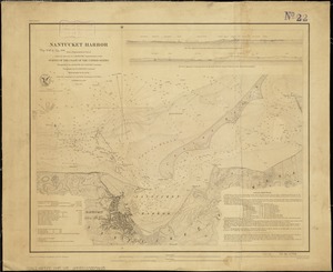
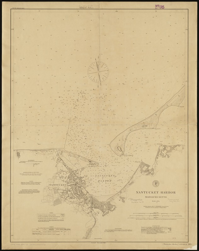
- Nantucket Harbor, Massachusetts
- Creator:
- U.S. Coast and Geodetic Survey
- Name on Item:
-
drawn by W.H. Benton.
- Date:
-
1889
- Format:
-
Maps/Atlases
- Location:
-
Boston Public Library
Norman B. Leventhal Map & Education Center - Collection (local):
-
Norman B. Leventhal Map & Education Center Collection
- Subjects:
-
Nautical charts--Massachusetts--Nantucket Harbor
Nantucket Harbor (Mass.)--Maps
- Places:
-
MassachusettsNantucket (county)Nantucket Island (island)Nantucket Harbor
- Extent:
- 1 chart ; 81 x 61 cm.
- Terms of Use:
-
No known copyright restrictions.
No known restrictions on use.
- Publisher:
-
Washington, D.C :
[U.S. Coast & Geodetic Survey]
- Scale:
-
Scale 1:10,000.
- Language:
-
English
- Notes:
-
(Nantucket Harbor) U.S.C. & G.S. 343.
- Identifier:
-
06_01_005153
- Call #:
-
G3762.N29 1889 .U8
- Barcode:
-
39999059009876