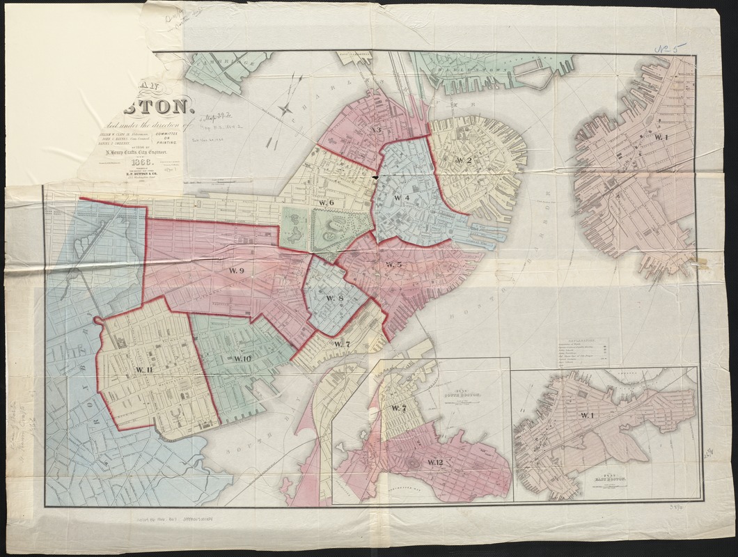
Plan of Boston
Item Information
- Title:
- Plan of Boston
- Creator:
- Boston (Mass.). Engineering Dept
- Name on Item:
-
corrected under the direction of Committee on Printing of 1864, by N. Henry Crafts ; drawn by H.M. Wightman ; engraved by C.A. Swett.
- Date:
-
1866
- Format:
-
Maps/Atlases
- Location:
-
Boston Public Library
Norman B. Leventhal Map & Education Center - Collection (local):
-
Norman B. Leventhal Map & Education Center Collection
- Subjects:
-
Boston (Mass.)--Maps
- Places:
-
MassachusettsSuffolk (county)Boston
- Extent:
- 1 map : col. ; 67 x 97 cm.
- Terms of Use:
-
No known copyright restrictions.
No known restrictions on use.
- Publisher:
-
Boston, Mass :
E.P. Dutton & Co.
- Scale:
-
Scale 1:6,000.
- Language:
-
English
- Notes:
-
Relief shown by hachures.
Oriented with north toward the upper right.
Insets: Plan of South Boston and Plan of East Boston.
Distance from City Hall depicted by cocentric circles.
"A. Meisel, Printer."
"Published at the Boston Map Store. E.P. Dutton & Co."
- Identifier:
-
06_01_003450
- Call #:
-
G3764.B6 1864 .B67
- Barcode:
-
39999059001154


