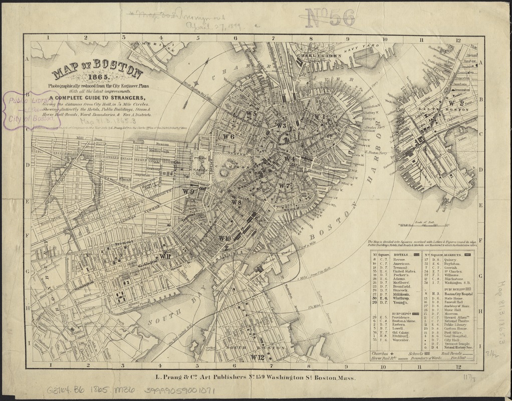
Map of Boston, 1865 : photographically reduced from the city engineer's plans, with all the latest improvements, a complete guide to strangers, giving the distances from City Hall in 1/4 mile circles, showing distinctly the hotels, public buildings, steam & horse rail-roads, ward boundaries & fire a. districts
Item Information
- Title:
- Map of Boston, 1865 : photographically reduced from the city engineer's plans, with all the latest improvements, a complete guide to strangers, giving the distances from City Hall in 1/4 mile circles, showing distinctly the hotels, public buildings, steam & horse rail-roads, ward boundaries & fire a. districts
- Date:
-
1865
- Format:
-
Maps/Atlases
- Location:
-
Boston Public Library
Norman B. Leventhal Map & Education Center - Collection (local):
-
Norman B. Leventhal Map & Education Center Collection
- Subjects:
-
Boston (Mass.)--Maps
- Places:
-
MassachusettsSuffolk (county)Boston
- Extent:
- 1 map ; 22 x 30 cm.
- Terms of Use:
-
No known copyright restrictions.
No known restrictions on use.
- Publisher:
-
Boston, Mass :
L. Prang & Co.
- Scale:
-
Scale [ca. 1:20,600].
- Language:
-
English
- Notes:
-
Oriented with north toward the upper right.
Relief shown by hachures.
Shows radial distances from City Hall.
"Entered according to Act of Congress in the Year 1862 by L. Prang & Co. in the Clerks Office of the District Court of Mass."
Includes index to points of interest.
- Identifier:
-
06_01_003442
- Call #:
-
G3764.B6 1865 .M36
- Barcode:
-
39999059001071


