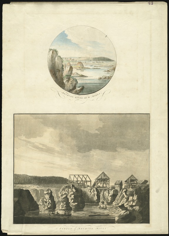
Mechios River near the mills : a sketch of Mechios mills
This map is also available in American Revolutionary Geographies Online (ARGO), a collections portal especially built for material relating to the American Revolutionary War Era. Visit ARGO to learn more about this item and explore the historical geography of North America in the late eighteenth century.
Item Information
- Title:
- Mechios River near the mills : a sketch of Mechios mills
- Title (alt.):
-
Sketch of Mechios mills
- Description:
-
This engraving of the Machias area in the Boston Public Library's Atlantic Neptune collection was struck from the plate held by the Massachusetts Historical Society. By 1770, several mills were built on the Machias River, as the region was ideal for producing lumber. Conflict erupted between the residents and the British Navy in 1775, and a number of sailors lost their lives. In early August of 1777, mere days after this image was engraved, the British attacked the town of Machias, and burned the settlement in retaliation for the uprising two years earlier.
- Creator:
- Des Barres, Joseph F. W. (Joseph Frederick Wallet), 1722-1824
- Date:
-
1777
- Format:
-
Maps/Atlases
- Location:
-
Boston Public Library
Norman B. Leventhal Map & Education Center - Collection (local):
-
Norman B. Leventhal Map & Education Center Collection
- Subjects:
-
Machias River (Washington County, Me.)--Pictorial works--Early works to 1800
- Places:
-
MaineAroostook (county)Machias
- Extent:
- 2 views on 1 sheet : aquatint and etching, sheet 79 x 57 cm.
- Terms of Use:
-
No known copyright restrictions.
No known restrictions on use.
- Publisher:
-
[London] :
Publish'd according to Act of Parliament by J.F.W. DesBarres Esqr
- Scale:
-
Not drawn to scale.
- Language:
-
English
- Notes:
-
Appears in the author's Atlantic Neptune, published for the use of the Royal Navy of Great Britain. London : Joseph F.W. Des Barres, 1777-[1781].
- Notes (exhibitions):
-
Exhibited: "Charting an Empire: The Atlantic Neptune" organized by the Norman B. Leventhal Map Center at the Boston Public Library, 2013.
- Identifier:
-
06_01_008133
- Call #:
-
G1106.P5 D47 1777
- Barcode:
-
30000003792542


