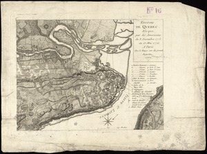
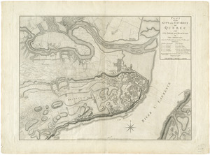
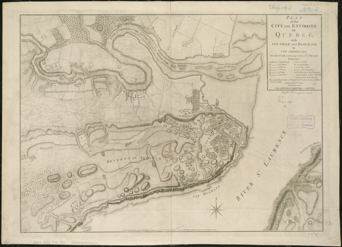
Plan of the city and environs of Quebec, with its siege and blockade by the Americans, from the 8th of December 1775 to the 13th of May 1776
This map is also available in American Revolutionary Geographies Online (ARGO), a collections portal especially built for material relating to the American Revolutionary War Era. Visit ARGO to learn more about this item and explore the historical geography of North America in the late eighteenth century.
Item Information
- Title:
- Plan of the city and environs of Quebec, with its siege and blockade by the Americans, from the 8th of December 1775 to the 13th of May 1776
- Creator:
- Faden, William, 1749-1836
- Name on Item:
-
engraved by Wm. Faden.
- Date:
-
1776
- Format:
-
Maps/Atlases
- Location:
-
Boston Public Library
Norman B. Leventhal Map & Education Center - Collection (local):
-
Norman B. Leventhal Map & Education Center Collection
- Subjects:
-
Québec (Québec)--History--Siege, 1775-1776--Maps--Early works to 1800
Québec (Québec)--History--Revolution, 1775-1783--Maps--Early works to 1800
- Places:
-
CanadaQuebec (province)Québec
- Extent:
- 1 map ; 45 x 62 cm.
- Terms of Use:
-
No known copyright restrictions.
No known restrictions on use.
- Publisher:
-
London :
Wm. Faden
- Scale:
-
Scale [ca. 1:7,300]
- Language:
-
English
- Notes:
-
Relief shown by hachures.
Indexed for points of interest.
Cataloging, conservation, and digitization made possible in part by The National Endowment for the Humanities: Exploring the human endeavor.
- Identifier:
-
06_01_006192
- Call #:
-
G3454.Q4S3 1776 .F3
- Barcode:
-
30000003453283