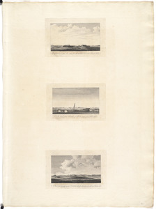
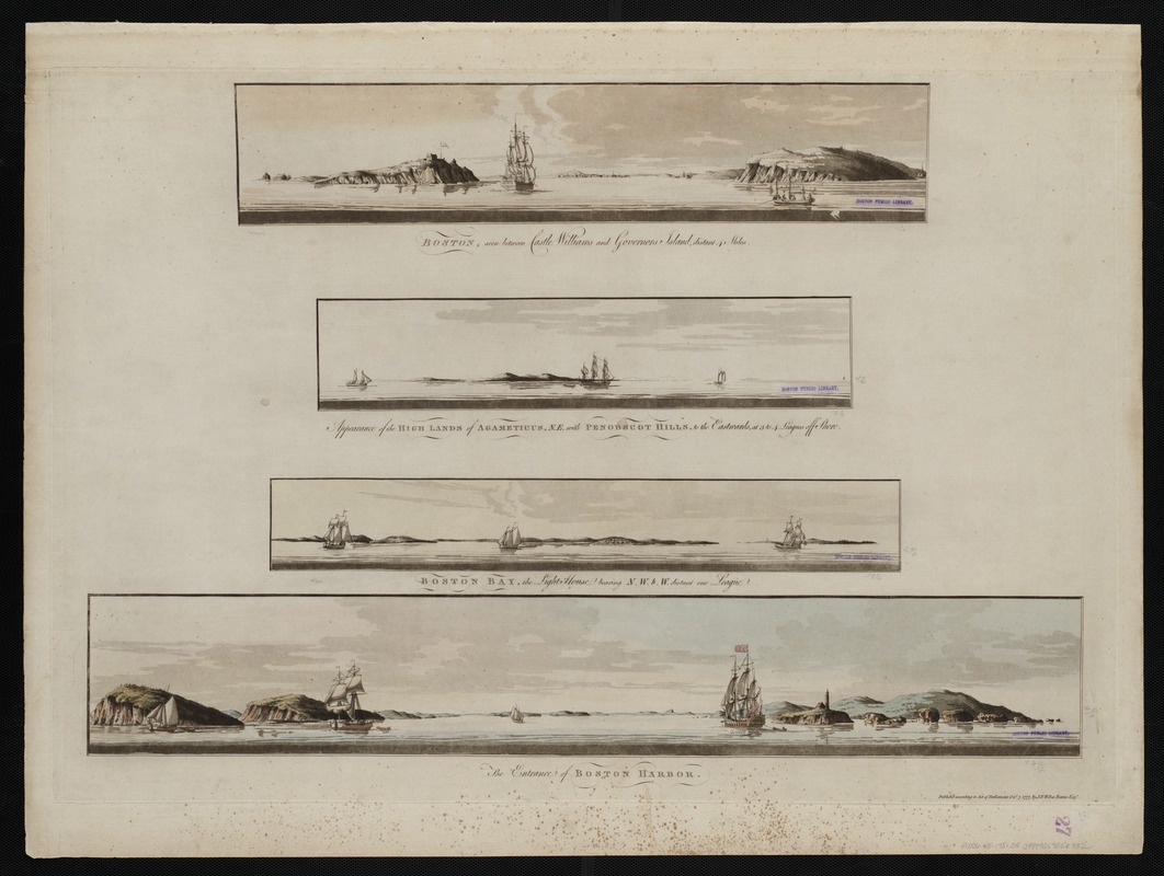
Boston, seen between Castle Williams and Governor's Island, distant 4 miles : Appearance of the high lands of Agameticus, N.E. with Penobscot Hills, to the eastwards, at 3 to 4 leagues off shore ; Boston Bay, the light house bearing N.W.b.W distant one league ; The entrance of Boston Harbor
This map is also available in American Revolutionary Geographies Online (ARGO), a collections portal especially built for material relating to the American Revolutionary War Era. Visit ARGO to learn more about this item and explore the historical geography of North America in the late eighteenth century.
Item Information
- Title:
- Boston, seen between Castle Williams and Governor's Island, distant 4 miles : Appearance of the high lands of Agameticus, N.E. with Penobscot Hills, to the eastwards, at 3 to 4 leagues off shore ; Boston Bay, the light house bearing N.W.b.W distant one league ; The entrance of Boston Harbor
- Title (alt.):
-
Appearance of the high lands of Agameticus, N.E. with Penobscot Hills, to the eastwards, at 3 to 4 leagues off shore
Boston Bay, the light house bearing N.W.b.W distant one league
The entrance of Boston Harbor
- Creator:
- Des Barres, Joseph F. W. (Joseph Frederick Wallet), 1722-1824
- Date:
-
1777
- Format:
-
Maps/Atlases
- Location:
-
Boston Public Library
Norman B. Leventhal Map & Education Center - Collection (local):
-
Norman B. Leventhal Map & Education Center Collection
- Subjects:
-
Boston Harbor (Mass.)--Pictorial works--Early works to 1800
- Places:
-
MassachusettsBoston Harbor
- Extent:
- 4 views on 1 sheet : hand col. ; on sheet 62 x 83 cm.
- Terms of Use:
-
No known copyright restrictions.
No known restrictions on use.
- Publisher:
-
[London] :
Published by J.F.W. Des Barres
- Scale:
-
Not drawn to scale.
- Language:
-
English
- Notes:
-
Aquatint with etching.
From the author's Atlantic Neptune.
- Identifier:
-
06_01_004513
- Call #:
-
G1106.P5 D47 1781
- Barcode:
-
30000003818413