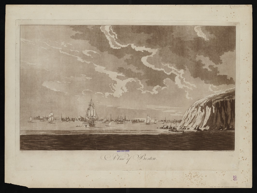
A view of Boston
This map is also available in American Revolutionary Geographies Online (ARGO), a collections portal especially built for material relating to the American Revolutionary War Era. Visit ARGO to learn more about this item and explore the historical geography of North America in the late eighteenth century.
Item Information
- Title:
- A view of Boston
- Description:
-
Viewing Boston from the ocean was not a novel concept originated by 19th century bird’s eye view artists. This Revolutionary War era landscape scene, published with a collection of nautical charts, depicted Boston Harbor as it would have appeared to approaching ships. While not technically a map or chart, coastal and headland views were also considered navigational aids. Such graphic images assisted ship captains in identifying prominent landmarks as they entered the harbor. Clearly visible on Boston’s late 18th-century skyline are numerous church spires and a flag on Beacon Hill.
- Creator:
- Des Barres, Joseph F. W. (Joseph Frederick Wallet), 1722-1824
- Date:
-
1779
- Format:
-
Maps/Atlases
- Location:
-
Boston Public Library
Norman B. Leventhal Map & Education Center - Collection (local):
-
Norman B. Leventhal Map & Education Center Collection
- Subjects:
-
Boston Harbor (Mass.)--Pictorial works--Early works to 1800
- Places:
-
MassachusettsBoston Harbor
- Extent:
- 1 view ; 42 x 72 cm.
- Terms of Use:
-
No known copyright restrictions.
No known restrictions on use.
- Publisher:
-
[London] :
Published by J.F.W. Des Barres
- Scale:
-
Not drawn to scale.
- Language:
-
English
- Notes:
-
Aquatint with etching.
Shows ships in Boston Harbor, with distant view of the city.
From the author's Atlantic Neptune.
- Notes (exhibitions):
-
Exhibited: "Unconventional Maps: Exploring the Stories of Cartographic Curiosities" organized by the Norman B. Leventhal Map Center at the Boston Public Library, 2011-2012.
- Identifier:
-
06_01_004512
- Call #:
-
G1106.P5 D47 1781
- Barcode:
-
30000003818410