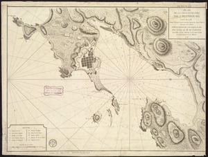
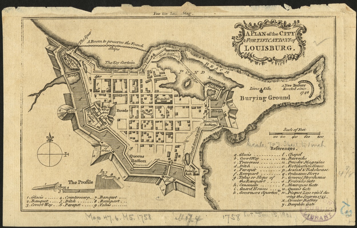
A Plan of the city & fortifications of Louisburg
This map is also available in American Revolutionary Geographies Online (ARGO), a collections portal especially built for material relating to the American Revolutionary War Era. Visit ARGO to learn more about this item and explore the historical geography of North America in the late eighteenth century.
Item Information
- Title:
- A Plan of the city & fortifications of Louisburg
- Date:
-
[1758?]
- Format:
-
Maps/Atlases
- Location:
-
Boston Public Library
Norman B. Leventhal Map & Education Center - Collection (local):
-
Norman B. Leventhal Map & Education Center Collection
- Subjects:
-
Fortification--Nova Scotia--Louisbourg--Maps--Early works to 1800
Louisbourg (N.S.)--Maps--Early works to 1800
- Places:
-
CanadaNova Scotia (province)Louisbourg
- Extent:
- 1 map ; 11 x 18 cm.
- Terms of Use:
-
No known copyright restrictions.
No known restrictions on use.
- Publisher:
-
London :
s.n.
- Scale:
-
Scale [ca. 1:8,500].
- Language:
-
English
- Notes:
-
In upper margin: For the Lond. Mag.
Includes index to locations in fort.
Cataloging, conservation, and digitization made possible in part by The National Endowment for the Humanities: Exploring the human endeavor.
- Identifier:
-
06_01_006206
- Call #:
-
G3424.L6 1758 .P53
- Barcode:
-
39999059021327