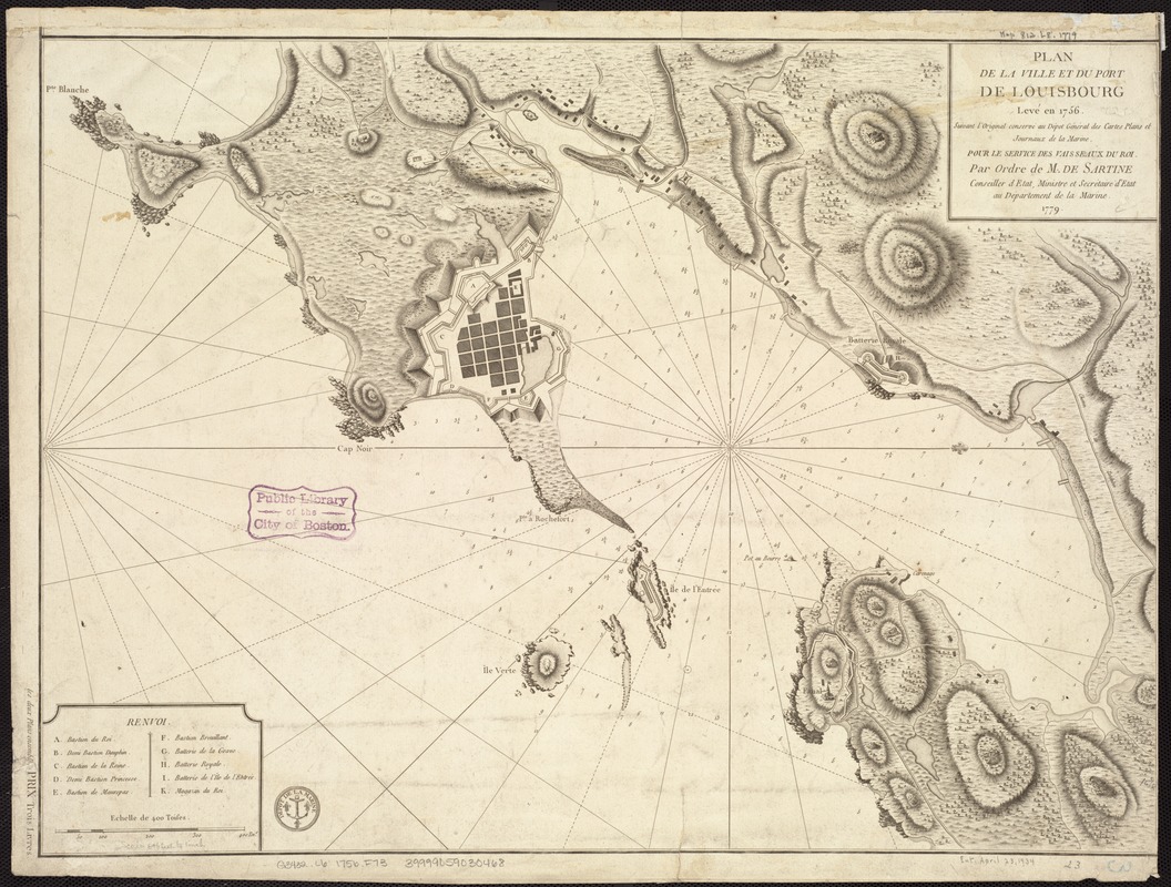
Plan de la ville et du port de Louisbourg levé en 1756
This map is also available in American Revolutionary Geographies Online (ARGO), a collections portal especially built for material relating to the American Revolutionary War Era. Visit ARGO to learn more about this item and explore the historical geography of North America in the late eighteenth century.
Item Information
- Title:
- Plan de la ville et du port de Louisbourg levé en 1756
- Creator:
- France. Dépôt des cartes et plans de la marine
- Name on Item:
-
Suivant l'original conservé au Dépôt général des cartes plans et journaux de la marine : Pour le service des vaisseaux du roi par ordre de M. de Sartine, conseiller d'Etat, ministre et secrétaire d'Etat au Départment de la marine : 1779.
- Date:
-
[1779]
- Format:
-
Maps/Atlases
- Location:
-
Boston Public Library
Norman B. Leventhal Map & Education Center - Collection (local):
-
Norman B. Leventhal Map & Education Center Collection
- Subjects:
-
Harbors--Nova Scotia--Louisbourg--Maps--Early works to 1800
Fortification--Nova Scotia--Louisbourg--Maps--Early works to 1800
Louisbourg (N.S.)--Buildings, structures, etc--Maps--Early works to 1800
- Places:
-
CanadaNova Scotia (province)Louisbourg
- Extent:
- 1 map ; 43 x 59 cm.
- Terms of Use:
-
No known copyright restrictions.
No known restrictions on use.
- Publisher:
-
Paris :
Départment de la marine
- Scale:
-
Scale ca. 1:8,000.
- Language:
-
French
- Notes:
-
Oriented with north to the right.
Relief shown by hachures. Depths shown by soundings.
Indexed for fortifications.
- Notes (date):
-
This date is inferred.
- Identifier:
-
06_01_007265
- Call #:
-
G3432.L6 1756 .F73
- Barcode:
-
39999059030468
- LCCN:
-
73696293


