Map of Boston and adjacent cities
Item Information
- Title:
- Map of Boston and adjacent cities
- Description:
-
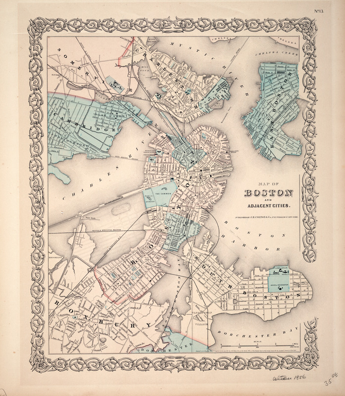
Produced by the firm of J.H. Colton and Company, a leading mid-19th century American publisher of steel engraved maps and atlases, this map portrays Boston just prior to the reclamation of Back Bay. The street grid of this area is dotted in anticipation of this important city venture. While the Mill Dam (currently Beacon Street) and the railroad crossings still dominate Back Bay, the modernization of this area is imminent. The dotted grid, which indicates the projected street plan for the area, is based on the work of David Sears, who acquired rights to a large area of the mud flats in the 1840s in anticipation of the land-filling project. This plan includes a scheme for an oval lake in the middle of Back Bay which Sears believed would make the adjacent house lots more desirable and would "ornament" the city.
- Creator:
- Colton, J. H. (Joseph Hutchins), 1800-1893
- Contributor:
- J.H. Colton & Co
- Name on Item:
-
J.H. Colton
- Date:
-
1855
- Format:
-
Maps/Atlases
- Location:
- Private Collection
- Collection (local):
-
Mapping Boston Collection
- Subjects:
-
Boston (Mass.)--Maps
- Places:
-
MassachusettsSuffolk (county)Boston
- Extent:
- 1 map : tinted ; 37 x 31 cm.
- Terms of Use:
-
No known copyright restrictions.
This work is licensed for use under a Creative Commons Attribution Non-Commercial Share Alike License (CC BY-NC-SA).

- Publisher:
-
New York :
J.H. Colton & Co.
- Scale:
-
Scale not given
- Language:
-
English
- Notes:
-
Appears in G.W. Colton's General atlas. New York. 1855.
- Identifier:
-
05_04_000079
- Barcode:
-
39999052509468


