Plan showing the principal portion of Boston : from the oldest authorities
Item Information
- Title:
- Plan showing the principal portion of Boston : from the oldest authorities
- Creator:
- Davis, Thomas W., surveyor
- Cartographer:
- Humbert, Pierre, Jr.
- Name on Item:
-
Thos. W. Davis, city surveyor.
- Date:
-
1893
- Format:
-
Maps/Atlases
- Location:
-
Boston Public Library
Norman B. Leventhal Map & Education Center - Collection (local):
-
Norman B. Leventhal Map & Education Center Collection
- Subjects:
-
Boston (Mass.)--Maps
- Places:
-
MassachusettsSuffolk (county)Boston
- Extent:
- 1 map : col. ; 121 x 129 cm.
- Terms of Use:
-
No known copyright restrictions.
No known restrictions on use.
- Publisher:
-
Boston :
[s.n.]
- Scale:
-
Scale 1:6,000.
- Language:
-
English
- Notes:
-
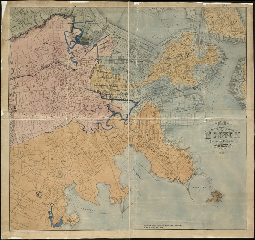
Oriented with north toward the upper right.
Shows wards, streets, railroads, Harbor Commissioners' line, some public buildings, and radial distances from City Hall.
Manuscript and stamped annotations, corrections, and paste-ons on "Plan showing the principal portion of Boston : from the latest authorities" by Thos. W. Davis, printed by Heliotype Printing Co. in 1888. "Oldest" and "Pierre Humbert Jr." tipped on in title block. Last two digits of date effaced and "93" added in ink. Historical boundaries and rivers added in manuscript ink and color. Historical names of some areas stamped on.
- Identifier:
-
06_01_004699
- Call #:
-
G3764.B6 1893 .H86
- Barcode:
-
39999059006955


