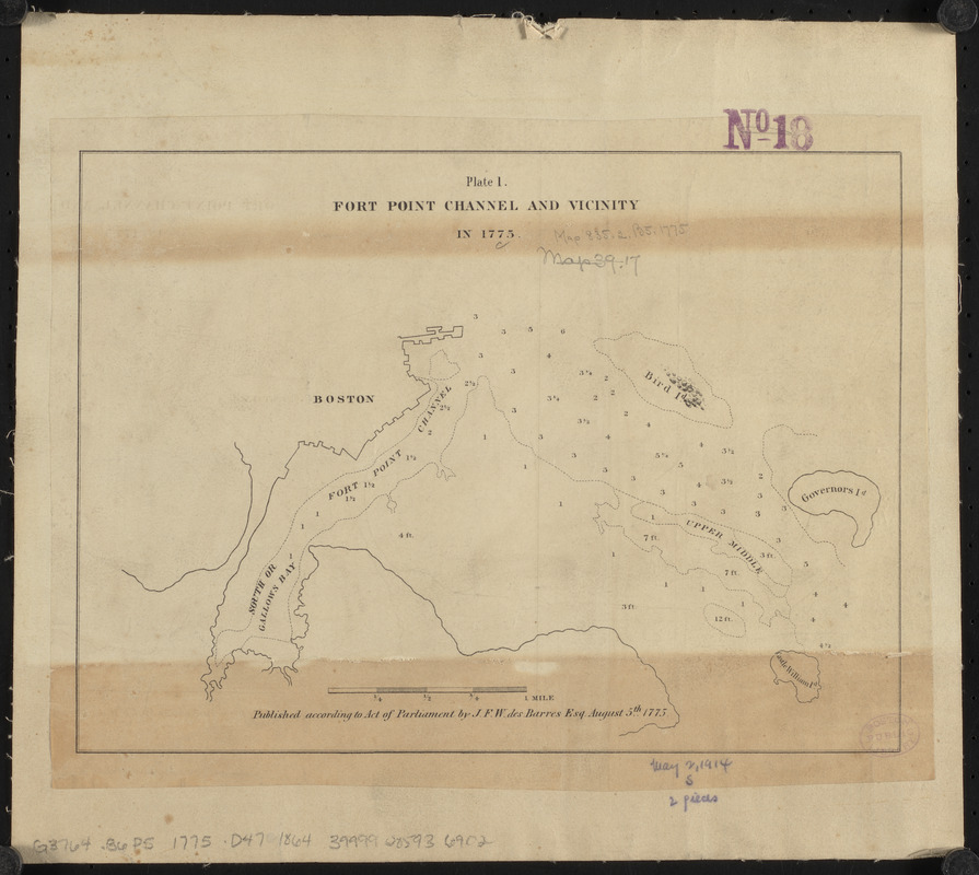
Fort Point Channel and vicinity in 1775
Item Information
- Title:
- Fort Point Channel and vicinity in 1775
- Title (alt.):
-
Plate 1 Fort Point Channel and vicinity in 1775
- Cartographer:
- Des Barres, Joseph F. W. (Joseph Frederick Wallet), 1729-1824
- Publisher:
- Boston (Mass.)
- Date:
-
1864
- Format:
-
Maps/Atlases
- Location:
-
Boston Public Library
Norman B. Leventhal Map & Education Center - Collection (local):
-
Norman B. Leventhal Map & Education Center Collection
- Subjects:
-
Nautical charts--Massachusetts--Boston--Maps
Fort Point Channel Area (Boston, Mass.)--Maps
- Places:
-
MassachusettsSuffolk (county)South Bay
MassachusettsSuffolk (county)Boston
- Extent:
- 1 map ; 20 x 28 cm
- Terms of Use:
-
No known copyright restrictions.
No known restrictions on use.
- Publisher:
-
[Boston, Mass.] :
[City of Boston]
- Scale:
-
Scale approximately 1:24,500
- Language:
-
English
- Notes:
-
Depths shown by soundings.
"Published according to Act of Parliament by J.F.W. des Barres Esq. August 5th 1775."
From City of Boston, city document no. 33, Mayor's communication, transmitting reports of the U.S. Harbor Commissioners.
- Identifier:
-
06_01_015485
- Call #:
-
G3764.B6P5 1775 .D47 1864
- Barcode:
-
39999085936902


