Toggle navigation
LMEC Home
Exhibitions
Georeferencing
Tools for Teachers
Collections
My Favorites
Sign Up / Log In
Search
Search the map portal
Map Collection
Map Collection
Map Sets
Search
Search
Search for
Search In
All Fields
Creator
Title
Subject
Place
Search All Digital Collections
Advanced Search
213 Results
My Search
Start Over
Date
1920
to
1924
Remove constraint Date: <span class='from'>1920</span> to <span class='to'>1924</span>
Filter your Search
Place
North and Central America
168
United States
151
Massachusetts
35
Europe
23
Boston
22
Suffolk (county)
22
Canada
13
Bristol (county)
12
more
Place
»
Topic
Fire risk assessment
32
Insurance surveys
32
Textile factories
23
Cotton manufacture
17
Boston (Mass.)--Maps
11
Europe--Maps
6
Longmeadow (Mass.)--Maps
5
Real property--Massachusetts--Boston--Maps
5
more
Topic
»
Date
1920
to
1924
[remove]
213
Date range begin
–
Date range end
Current results range from
1770
to
1999
1920
to
1920
74
1921
to
1921
62
1922
to
1922
58
1923
to
1923
41
1924
to
1924
59
Creator
Associated Mutual Insurance Companies
23
Geological Survey (U.S.)
12
Richards Map Company
9
Rand McNally and Company
8
United States. Army. Engineer Reproduction Plant
7
Associated Factory Mutual Fire Insurance Companies
5
France. Armée. Groupe de canevas de tir
5
Price & Lee Co.
5
more
Creator
»
Format
Maps/Atlases
212
Photographs
1
Georeferenced
Yes
16
No
197
Collection
Norman B. Leventhal Map & Education Center Collection
166
American Textile History Museum Image Collection
32
Boston and New England Maps
18
Urban Maps
17
Massachusetts Real Estate Atlases
8
Lucius Beebe Memorial Library Historic Maps
3
American Revolutionary War-Era Maps
1
Boston Redevelopment Authority Collection
1
more
Collection
»
Available to use
No known restrictions
170
Creative Commons license
1
Search Constraints
Sort by relevance
relevance
title
date (asc)
date (desc)
Number of results to display per page
20 per page
10
per page
20
per page
50
per page
100
per page
View results as:
grid view
map view
Search Results
1.
Acushnet Mill Corp. (Cotton Mill), New Bedford, Mass. [insurance map]
2.
The Alaska Railroad
3.
Androscoggin Mills (Cotton Mill), Lewiston, Me. [insurance map]
4.
Androscoggin Mills "No. 5 Mill" formerly Avon Mfg. Co., Lewiston, Me. [insurance map]
5.
Arlington Mills "Hoosac Worsted Mills Dept." North Adams, Mass. [insurance map]
6.
Artarias karte der Russischen sozialistischen förderativen Sowjet-Republik (R.S.F.S.R.)
7.
Atlas of the city of Boston : West Roxbury
8.
Atlas of the city of Boston : Boston proper and Back Bay : from actual surveys and official plans
9.
Atlas of the city of Boston : Charlestown and East Boston : from actual surveys and official plans
10.
Atlas of the city of Boston : West Roxbury : from actual surveys and official plans
11.
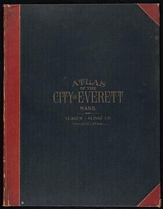
Atlas of the city of Everett, Mass.
12.
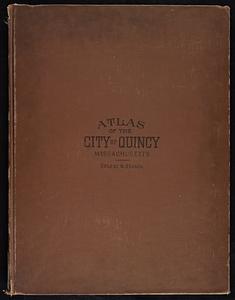
Atlas of the city of Quincy, Norfolk County, Massachusetts : compiled from the latest plans and original surveys
13.
Aviation map of United States : featuring landing fields, improved, unimproved
14.
Bartholomew's pocket plan of Edinburgh & suburbs
15.
Base map of Illinois
16.
Berkshire Woolen Co., Pittsfield, Mass. [insurance map]
17.
Boston Elevated Railway lines 1921
18.
Boston Harbor
19.
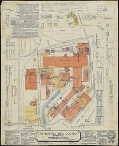
The Boston Mfg. Co., 1901 (Cotton Mill), Waltham, Mass.
20.
Boston traffic map showing one way streets and parking spaces
‹ Prev
Next ›
1
2
3
4
5
…
10
11
![Acushnet Mill Corp. (Cotton Mill), New Bedford, Mass. [insurance map]](https://bpldcassets.blob.core.windows.net/derivatives/images/commonwealth:ww72bz30x/image_thumbnail_300.jpg)

![Androscoggin Mills (Cotton Mill), Lewiston, Me. [insurance map]](https://bpldcassets.blob.core.windows.net/derivatives/images/commonwealth:4j03df194/image_thumbnail_300.jpg)
![Androscoggin Mills "No. 5 Mill" formerly Avon Mfg. Co., Lewiston, Me. [insurance map]](https://bpldcassets.blob.core.windows.net/derivatives/images/commonwealth:2r36vc17g/image_thumbnail_300.jpg)
![Arlington Mills "Hoosac Worsted Mills Dept." North Adams, Mass. [insurance map]](https://bpldcassets.blob.core.windows.net/derivatives/images/commonwealth:2r36vc58q/image_thumbnail_300.jpg)


![Berkshire Woolen Co., Pittsfield, Mass. [insurance map]](https://bpldcassets.blob.core.windows.net/derivatives/images/commonwealth:2r36vc64v/image_thumbnail_300.jpg)