Toggle navigation
LMEC Home
Exhibitions
Georeferencing
Tools for Teachers
Collections
My Favorites
Sign Up / Log In
Search
Search the map portal
Map Collection
Map Collection
Map Sets
Search
Search
Search for
Search In
All Fields
Creator
Title
Subject
Place
Search All Digital Collections
Advanced Search
154 Results
My Search
Start Over
Date
1903
Remove constraint Date: <span class='single'>1903</span>
Filter your Search
Place
North and Central America
133
United States
114
Massachusetts
45
Boston
32
Suffolk (county)
32
Canada
11
Oklahoma
10
New York
7
more
Place
»
Topic
Boston (Mass.)--Maps
23
Landowners--Massachusetts--Boston--Maps
20
Indian reservations--Oklahoma--Maps
9
Indian Territory--Maps
7
Oklahoma--Maps
7
Boston (Mass.)--History--Colonial period, ca. 1600-1775--Maps
5
Homeowners--Massachusetts--Boston--Maps
5
Cambridge (Mass.)--Maps
3
more
Topic
»
Date
1903
[remove]
154
Date range begin
–
Date range end
Current results range from
1770
to
1999
1903
to
1903
154
Creator
United States. Post Office Dept
34
Lamb, George
16
United States. Commission to the Five Civilized Tribes
8
Julius Bien & Co.
6
Scarborough Company
5
United States. Post Office Department
5
Lamb, George.
4
Canada. Department of the Interior
3
more
Creator
»
Format
Maps/Atlases
152
Books
1
Photographs
1
Prints
1
Georeferenced
Yes
24
No
130
Collection
Norman B. Leventhal Map & Education Center Collection
146
Boston and New England Maps
23
Urban Maps
21
Massachusetts Real Estate Atlases
3
Robert E. Diefenbach Map Collection at Phillips Academy
3
Maritime Charts and Atlases
2
American Revolutionary War-Era Maps
1
Lucius Beebe Memorial Library Historic Maps
1
more
Collection
»
Available to use
No known restrictions
150
Search Constraints
Sort by relevance
relevance
title
date (asc)
date (desc)
Number of results to display per page
20 per page
10
per page
20
per page
50
per page
100
per page
View results as:
grid view
map view
Search Results
141.
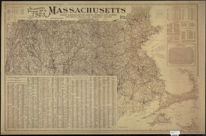
Scarborough's topographic map of Massachusetts : showing railroads, electric railways, steamboat lines, highways, post offices,...
142.
A small map of the sea coast of New England together with the outlines of several of the provinces lying thereon, 1738
143.
The south part of New-England, as it is planted this yeare, 1635
144.
State of Chiapas
145.
State of Oaxaca
146.
To his excellency William Shirley Esqr., Captain General and Commander in Chief, in and over his Majesty's province of the...
147.
Touring road map of Chicago and environs : 6 counties
148.
Tourist's map of Scotland : reduced by permission from the Ordnance Survey by John Bartholomew, F.R.G.S.
149.
Town of Nahant
150.
United States, including territories and insular possessions, showing the extent of public surveys, Indian, military and forest...
151.
Vallée de l'Amazone de Faro a Alemquer, Rio Trombetas - Rio Ariramba
152.
Vertical sections to accompany the geological map of the Boulder Belt, East Coolgardie, G.F.
153.
View of Boston freight terminals, the New York, New Haven & Hartford Railroad
154.
Western part of the United States of America including all its newly acquired territory
‹ Prev
Next ›
1
2
…
4
5
6
7
8