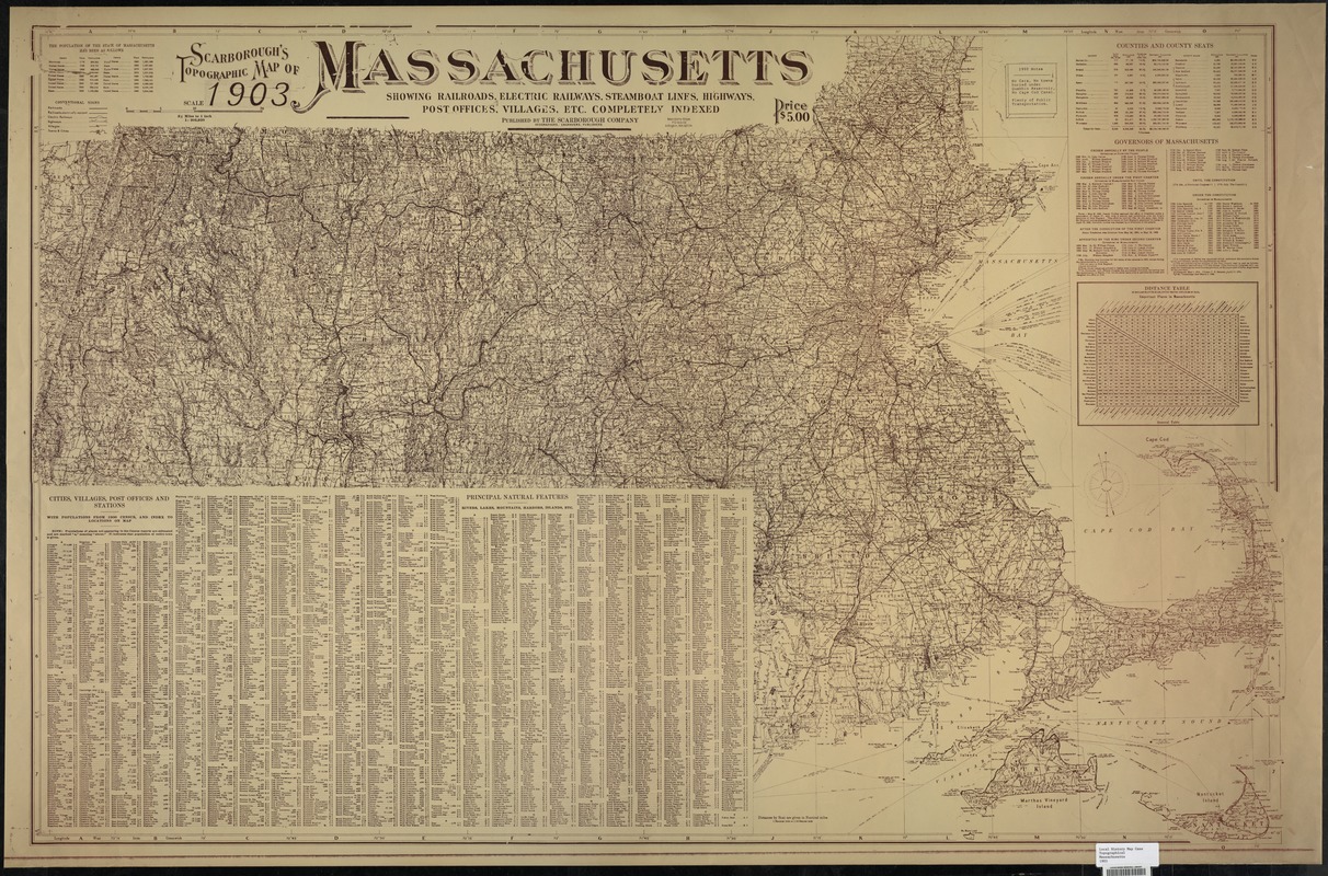
Scarborough's topographic map of Massachusetts : showing railroads, electric railways, steamboat lines, highways, post offices, villages, etc.
Item Information
- Title:
- Scarborough's topographic map of Massachusetts : showing railroads, electric railways, steamboat lines, highways, post offices, villages, etc.
- Title (alt.):
-
Topographic map of Massachusetts
- Creator:
- Scarborough Company
- Date:
-
1903
- Format:
-
Maps/Atlases
- Genre:
-
Topographic maps
- Location:
- Lucius Beebe Memorial Library
- Collection (local):
-
Lucius Beebe Memorial Library Historic Maps
- Places:
-
Massachusetts
- Extent:
- 1 map : col., mounted on linen ; 95 x 146 cm. folded to 27 x 13 cm.
- Terms of Use:
-
No known copyright restrictions.
No known restrictions on use.
- Publisher:
-
Boston, Mass. :
The Company
- Scale:
-
Scale 1:205,920. 3 1/4 miles to 1 in.
- Language:
-
English
- Notes:
-
Relief shown by hachures and spot heights bathymetry by isolines.
Includes index.
- Call #:
-
Local History Map Case Topographical Massachusetts 1903
- Barcode:
-
31392003576281


