Toggle navigation
LMEC Home
Exhibitions
Georeferencing
Tools for Teachers
Collections
My Favorites
Sign Up / Log In
Search
Search the map portal
Map Collection
Map Collection
Map Sets
Search
Search
Search for
Search In
All Fields
Creator
Title
Subject
Place
Search All Digital Collections
Advanced Search
1484 Results
My Search
Start Over
Subject
"Boston (Mass.)--Maps"
Remove constraint Subject: "Boston (Mass.)--Maps"
Filter your Search
Place
North and Central America
1,483
United States
1,481
Suffolk (county)
1,399
Boston
1,395
Massachusetts
1,099
Boston Harbor
126
Roxbury
91
Charlestown
71
more
Place
»
Topic
Boston (Mass.)--Maps
747
City planning--Massachusetts--Boston--Maps
407
Real property--Massachusetts--Boston--Maps
245
Urban renewal--Massachusetts--Boston--Maps
245
Landowners--Massachusetts--Boston--Maps
161
Buildings--Massachusetts--Boston--Maps
123
Land use--Massachusetts--Boston--Maps
99
Roxbury (Boston, Mass.)--Maps
90
more
Topic
»
Date
Date range begin
–
Date range end
Current results range from
1689
to
2023
View distribution
Creator
Boston Redevelopment Authority
387
Bromley, George Washington
69
Bromley, Walter Scott
68
G.W. Bromley & Co.
46
Geo. H. Walker & Co
28
Boston (Mass.). Engineering Dept
21
Boynton, George W., d. 1884
21
Sampson, Davenport & Co
21
more
Creator
»
Format
Maps/Atlases
1,481
Manuscripts
50
Drawings/Illustrations
5
Posters
1
Prints
1
Georeferenced
Yes
140
No
1,344
Collection
Boston and New England Maps
1,209
Urban Maps
1,015
Norman B. Leventhal Map & Education Center Collection
1,003
Boston Redevelopment Authority Collection
449
American Revolutionary War-Era Maps
129
Mapping Boston Collection
52
Massachusetts Real Estate Atlases
38
Maritime Charts and Atlases
28
more
Collection
»
Available to use
No known restrictions
1,301
Creative Commons license
116
Search Constraints
Sort by relevance
relevance
title
date (asc)
date (desc)
Number of results to display per page
20 per page
10
per page
20
per page
50
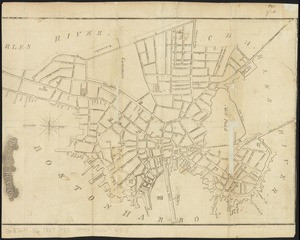
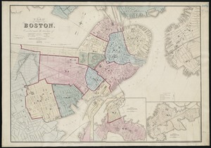
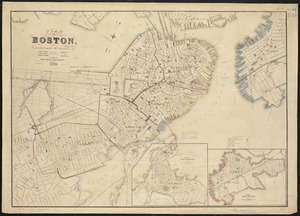
per page
100
per page
View results as:
grid view
map view
Search Results
141.
New map of Boston giving all points of interest : with every railway & steamboat terminus, prominent hotels, theatres & public...
142.
New map of Boston giving all points of interest : with every railway & steamboat terminus, prominent hotels, theatres & public...
143.
New map of the central portion of Boston
144.
New map of the vicinity of Boston, with the dates of settlement and distance from the capital
145.
New map of the vicinity of Boston, with the dates of settlement and distance from the capital
146.
A new plan of Boston : drawn from the best authorities with the latest improvements, additionas and corrections
147.
A new plan of ye great town of Boston in New England in America with the many additionall buildings & new streets to the year 1743
148.
Official map of Boston
149.
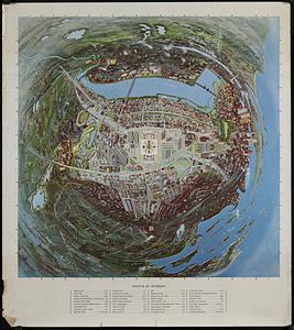
Panoramic view of Boston centered on the Prudential Tower
150.
Pianta della città di Boston
151.
Plan de Boston : cette ville est composée de quatre mille maisons, et d'environ vingt mille habitans, on compte par an jusqu'a...
152.
Plan de Boston : cette ville est composée de quatre mille maisons, et d'environ vingt mille habitans
153.
Plan de la ville de Boston et ses environs
154.
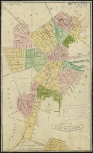
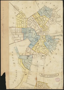
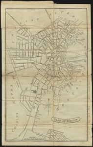
Plan of Boston
155.
Plan of Boston
156.
Plan of Boston
157.
Plan of Boston
158.
Plan of Boston
159.
Plan of Boston
160.
Plan of Boston
‹ Prev
Next ›
1
2
…
4
5
6
7
8
9
10
11
12
…
74
75