Toggle navigation
LMEC Home
Exhibitions
Georeferencing
Tools for Teachers
Collections
My Favorites
Sign Up / Log In
Search
Search the map portal
Map Collection
Map Collection
Map Sets
Search
Search
Search for
Search In
All Fields
Creator
Title
Subject
Place
Search All Digital Collections
Advanced Search
13385 Results
Filter your Search
Place
North and Central America
10,111
United States
8,249
Massachusetts
2,691
Suffolk (county)
1,664
Boston
1,621
Europe
1,386
Canada
949
New York
640
more
Place
»
Topic
Boston (Mass.)--Maps
741
City planning--Massachusetts--Boston--Maps
418
United States--History--Revolution, 1775-1783--Maps
329
United States--Maps
315
Urban renewal--Massachusetts--Boston--Maps
254
Real property--Massachusetts--Boston--Maps
252
Massachusetts--Maps
219
Insurance surveys
197
more
Topic
»
Date
Date range begin
–
Date range end
Current results range from
1482
to
2023
View distribution
Creator
United States. Hydrographic Office
595
Boston Redevelopment Authority
403
Des Barres, Joseph F. W. (Joseph Frederick Wallet), 1722-1824
247
Royal United Services Institute for Defence and Security Studies
160
Jefferys, Thomas, -1771
154
George, III, King of Great Britain, 1738-1820
152
George, IV, King of Great Britain, 1762-1830
151
O.H. Bailey & Co
148
more
Creator
»
Format
Maps/Atlases
13,205
Manuscripts
985
Prints
102
Books
49
Drawings/Illustrations
44
Photographs
15
Objects/Artifacts
13
Documents
7
more
Format
»
Georeferenced
Yes
979
No
12,406
Collection
Norman B. Leventhal Map & Education Center Collection
8,891
American Revolutionary War-Era Maps
3,305
Boston and New England Maps
2,804
Urban Maps
2,397
Maritime Charts and Atlases
1,150
William L. Clements Library Collection
910
Library of Congress Collection
618
Boston Redevelopment Authority Collection
475
more
Collection
»
Available to use
No known restrictions
9,952
Creative Commons license
1,677
Search Constraints
Sort by relevance
relevance
title
date (asc)
date (desc)
Number of results to display per page
20 per page
10
per page
20
per page
50
per page
100
per page
View results as:
grid view
map view
Search Results
12481.
Topographische Carte : Hundert Quadrat-Meilen um Berlin
12482.
Topographische kaart der residentie Bagelen : opgenomen ten gevolge gouvernements besluit dd. 26 Mei 1857 no. 4 onder de...
12483.
Topographische kaart der residentie Djokjakarta : opgenomen ingevolge gouvernements beluit dd. 9 Julij 1861 no. 6, door de...
12484.
Topographische kaart der residentie Japara : opgenomen ingevolge gouvernements besluit dd. 6 Julij 1866 no. 8 van November 1886...
12485.
Topographische kaart der residentie Pekalongan : opgenomen ingevolge gouvernements besluit dd. 27 Mei 1863 no. 19, door de...
12486.
Topographische karte der gegend um Berlin
12487.
Topography of Jefferson County, Kentucky : from U.S. Geological Survey topographic atlas sheets surveyed in 1904-1910
12488.
[Torbay]
12489.
[Torbay]
12490.
[Torbay]
12491.
[Torbay]
12492.
[Torbay]
12493.
Torrington, Conn : 1889
12494.
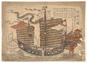
Tosen zozu
12495.
Total foreign-born
12496.
Total war battle map
12497.
Totius Alsatiae : novissima tabula qua simul Sundgovia, Brisigavia, Otenavia, maxima pars marchionatus Badensis, nec non aliae...
12498.
Totius Americae descriptio nova
12499.
Totius Americae septentrionalis et meridionalis novissima repræsentatio quam ex singulis recantium geographorum tabulis...
12500.
Totius Iutiae generalis accurata delincatio
‹ Prev
Next ›
1
2
…
621
622
623
624
625
626
627
628
629
…
669
670


![[Torbay]](https://bpldcassets.blob.core.windows.net/derivatives/images/commonwealth:z603vj95z/image_thumbnail_300.jpg)
![[Torbay]](https://bpldcassets.blob.core.windows.net/derivatives/images/commonwealth:z603vj992/image_thumbnail_300.jpg)
![[Torbay]](https://bpldcassets.blob.core.windows.net/derivatives/images/commonwealth:z603vk01w/image_thumbnail_300.jpg)
![[Torbay]](https://bpldcassets.blob.core.windows.net/derivatives/images/commonwealth:z603vj97h/image_thumbnail_300.jpg)
![[Torbay]](https://bpldcassets.blob.core.windows.net/derivatives/images/commonwealth:ws859h01x/image_thumbnail_300.jpg)