Toggle navigation
LMEC Home
Exhibitions
Georeferencing
Tools for Teachers
Collections
My Favorites
Sign Up / Log In
Search
Search the map portal
Map Collection
Map Collection
Map Sets
Search
Search
Search for
Search In
All Fields
Creator
Title
Subject
Place
Search All Digital Collections
Advanced Search
13385 Results
Filter your Search
Place
North and Central America
9,353
United States
7,078
Suffolk (county)
1,664
Boston
1,621
Europe
1,035
Canada
949
Massachusetts
794
New York
532
more
Place
»
Topic
Boston (Mass.)--Maps
741
City planning--Massachusetts--Boston--Maps
418
United States--History--Revolution, 1775-1783--Maps
329
United States--Maps
315
Urban renewal--Massachusetts--Boston--Maps
254
Real property--Massachusetts--Boston--Maps
252
Massachusetts--Maps
219
Insurance surveys
197
more
Topic
»
Date
Date range begin
–
Date range end
Current results range from
1482
to
2023
View distribution
Creator
United States. Hydrographic Office
595
Boston Redevelopment Authority
403
Des Barres, Joseph F. W. (Joseph Frederick Wallet), 1722-1824
247
Royal United Services Institute for Defence and Security Studies
160
Jefferys, Thomas, -1771
154
George, III, King of Great Britain, 1738-1820
152
George, IV, King of Great Britain, 1762-1830
151
O.H. Bailey & Co
148
more
Creator
»
Format
Maps/Atlases
13,205
Manuscripts
985
Prints
102
Books
49
Drawings/Illustrations
44
Photographs
15
Objects/Artifacts
13
Documents
7
more
Format
»
Georeferenced
Yes
979
No
12,406
Collection
Norman B. Leventhal Map Center Collection
8,891
American Revolutionary War-Era Maps
3,305
Boston and New England Maps
2,804
Urban Maps
2,397
Maritime Charts and Atlases
1,150
William L. Clements Library Collection
910
Library of Congress Collection
618
Boston Redevelopment Authority Collection
475
more
Collection
»
Available to use
No known restrictions
9,952
Creative Commons license
1,677
Search Constraints
Sort by date (desc)
relevance
title
date (asc)
date (desc)
Number of results to display per page
20 per page
10
per page
20
per page
50
per page
100
per page
View results as:
grid view
map view
Search Results
12341.
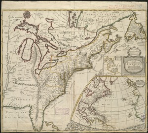
A new map of the English empire in America viz. Virginia, Maryland, Carolina, Pennsylvania, New York, New Iarsey, New England,...
12342.
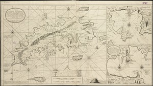
Nieuwe en aldereerste afteekening van 't eyland St. Thomas : met alle desselfs havenen, anker plaatse en geleegentheden is...
12343.
Carte de la Louisiane et du cours de Mississipi
12344.
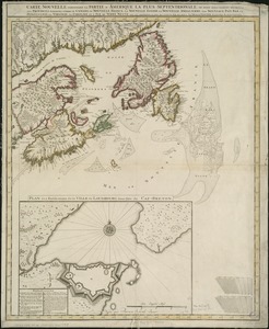
Carte nouvelle contenant la partie d'Amerique la plus septentrionale, ou sont exactement dêcrites les provinces suivantes...
12345.
Grand theatre de la guerre en Amerique suivant les plus nouvelles observations des Espagnols, Anglois, François & Hollandois
12346.
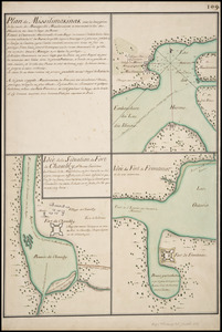
Plan de Missilimakinak avec la description de la route du Missisipi ; Idée de la situation du fort de Chambly, et des ses...
12347.
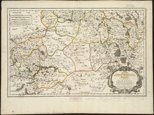
Rhemi : Partie meridionale du dioecese, et archevesché de Rheims en Champagne : la ou sont les Duché, et pairrie partie du...
12348.
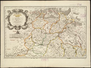
Rhemi : partie septentrle du Dioecse et Archevesché de Rheims en Champagne : la ou sont les Bailiage, Duche, et Eslection de...
12349.
The seat of war in ye North : or a map of the Baltick, with part of the North Sea ... posture of affaris
12350.
The seat of war in ye North : or a map of the Baltick, with part of the North Sea ... posture of affaris
12351.
A chart of the coast of Barbaria with the western, Canaria, & Cape de Verd, isles
12352.
Perigrinatie ofte veertich-iarige reyse der kindern Israëls, uyt Egypten door de Roode Zee, ende de woestyne, tot in't...
12353.
Totius Americae descriptio nova
12354.
A map of the West-Indies or the islands of America in the North Sea : with ye adjacent countries; explaning [sic] what belongs...
12355.
A map of the West-Indies or the islands of America in the North Sea : with ye adjacent countries; explaning [sic] what belongs...
12356.
A new and exact map of the dominions of the King of Great Britain on ye continent of North America : containing Newfoundland,...
12357.
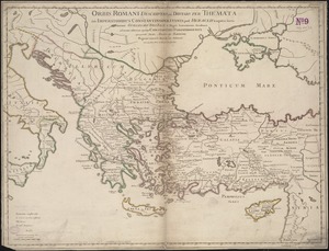
Orbis Romani descriptio : seu divisio per themata sub Imperatoribus Constantinopolitanis post Heraclii tempora facta
12358.
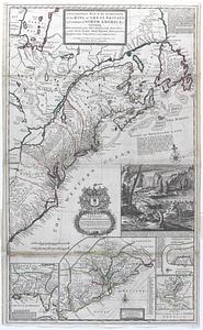
This map of North America, according to ye newest and most exact observations is most humbly dedicated by your Lordship's most...
12359.
Carolina is by vertue of a warr and under of hand and se all of the Right Honble. Charles Craven, Esqt. Governr. of this...
12360.
Insubres in Segusianis : partie du dioecese, et Archevesché de Lyon : partie méridionale de la Bresse du Bugey, et Valromey,...
‹ Prev
Next ›
1
2
…
614
615
616
617
618
619
620
621
622
…
669
670