Toggle navigation
LMEC Home
Exhibitions
Georeferencing
Tools for Teachers
Collections
My Favorites
Sign Up / Log In
Search
Search the map portal
Map Collection
Map Collection
Map Sets
Search
Search
Search for
Search In
All Fields
Creator
Title
Subject
Place
Search All Digital Collections
Advanced Search
149 Results
My Search
Start Over
1886
Remove constraint 1886
Filter your Search
Place
North and Central America
117
United States
93
Massachusetts
43
Middlesex (county)
19
Asia
16
Suffolk (county)
14
Boston
12
Worcester (county)
10
more
Place
»
Topic
Zoning
9
Boston (Mass.)--Maps
8
China--Historical geography--Maps
6
Brookline (Mass.)--Maps
3
Massachusetts--Maps
3
Atlantic Coast (N.S.)--Maps
2
Atlantic Coast (New England)--Maps
2
Boston (Mass.)--Aerial views
2
more
Topic
»
Date
Date range begin
–
Date range end
Current results range from
1831
to
1994
View distribution
Creator
United States. Hydrographic Office
37
Burleigh, L. R., 1853-1923
22
Herrmann, Albert, 1886-1945
11
Comey, Arthur C. (Arthur Coleman), 1886-1954
10
Franke, M. (Max)
7
Waddey, J. A. (John A.)
6
Birch, C. E. (Charles E.)
5
Ruebsam, E. A. (E. August)
5
more
Creator
»
Format
Maps/Atlases
149
Georeferenced
Yes
10
No
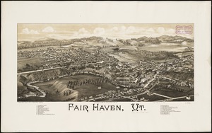
139
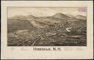
Collection
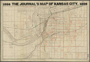
Norman B. Leventhal Map & Education Center Collection
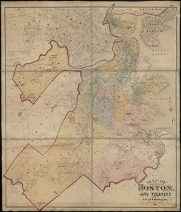
133
Urban Maps
65
Boston and New England Maps
58
Maritime Charts and Atlases
43
Lucius Beebe Memorial Library Historic Maps
10
Massachusetts Real Estate Atlases
5
Town plans, 1830
1
Available to use
No known restrictions
133
Search Constraints
Sort by relevance
relevance
title
date (asc)
date (desc)
Number of results to display per page
20 per page
10
per page
20
per page
50
per page
100
per page
View results as:
grid view
map view
Search Results
101.
Atlas of the city of Chelsea and the towns of Revere and Winthrop : from actual surveys and official plans
102.
Atlas of the city of Newton, Massachusetts : compiled from actual surveys and records
103.
Bellows Falls, Vt
104.
East River front of New York and Brooklyn from the Battery and Red Hook to Blackwell's Island
105.
Edgartown, Duke's County, Martha's Vineyard Id., Mass
106.
Fair Haven, Vt
107.
Hinsdale, N.H
108.
Kansas City, Missouri and its surroundings
109.
Map of Boston and of a part of its suburbs : showing public recreation grounds, burial grounds and certain other public...
110.
Map of Boston and the country adjacent, from actual surveys
111.
Map of the city of Boston and vicinity
112.
Map of Woodstock, Conn
113.
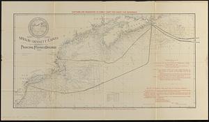
Map showing the Mackay-Bennett cables in the vicinity of the principal fishing grounds
114.
Pigeon Cove, Rockport, Essex County, Mass
115.
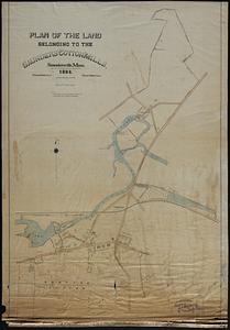
Plan of the land belonging to the Saunders Cotton Mills, Saundersville, Mass.
116.
Preliminary plan for the extension of Commonwealth Avenue along Beacon Street Brookline : showing connection with Chestnut Hill...
117.
Plan of region west of Back Bay Park, Boston, Mass. : proposed improvements
118.
Arabia--Red Sea, Mokha Road : from a British survey in 1882
119.
Atlas of Gardner town, Massachusetts
120.
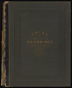
Atlas of the city of Cambridge, Massachusetts
‹ Prev
Next ›
1
2
3
4
5
6
7
8