Toggle navigation
LMEC Home
Exhibitions
Georeferencing
Tools for Teachers
Collections
My Favorites
Sign Up / Log In
Search
Search the map portal
Map Collection
Map Collection
Map Sets
Search
Search
Search for
Search In
All Fields
Creator
Title
Subject
Place
Search All Digital Collections
Advanced Search
163 Results
My Search
Start Over
1876
Remove constraint 1876
Filter your Search
Place
North and Central America
116
United States
100
Massachusetts
43
South America
21
Suffolk (county)
19
Boston
17
Chile
12
Europe
12
more
Place
»
Topic
Coasts--Chile--Maps
11
Long Trail (Vt.)--Maps
9
Trails--Vermont--Maps
9
Boston (Mass.)--Maps
8
Hiking--Vermont--Maps
5
Gettysburg (Pa.)--Maps
4
Gettysburg, Battle of, Gettysburg, Pa., 1863--Maps
4
Hiking--Vermont--Long Trail--Maps
4
more
Topic
»
Date
Date range begin
–
Date range end
Current results range from
1760
to
1932
View distribution
Creator
United States. Hydrographic Office
50
Boston (Mass.). Park Commissioners
9
Congdon, Herbert Wheaton, 1876-1965
9
Campbell-Copeland, T. (Thomas)
7
Harper & Brothers
7
Bailey, H. H. (Howard Heston), 1836-1878
6
O.H. Bailey & Co
6
Bachelder, John B. (John Badger), 1825-1894
4
more
Creator
»
Format
Maps/Atlases
161
Manuscripts
3
Books
2
Ephemera
1
Georeferenced
Yes
14
No
149
Collection
Norman B. Leventhal Map & Education Center Collection
159
Boston and New England Maps
52
Maritime Charts and Atlases
52
Urban Maps
49
American Revolutionary War-Era Maps
2
David Judkins Weaver Papers
1
Library of Congress Collection
1
MacLean Collection Map Library
1
more
Collection
»
Available to use
No known restrictions
158
Creative Commons license
2
Search Constraints
Sort by relevance
relevance
title
date (asc)
date (desc)
Number of results to display per page
20 per page
10
per page
20
per page
50
per page
100
per page
View results as:
grid view
map view
Search Results
101.
Political map of West Virginia 1888
102.
[Map] of the state of Massachusetts
103.
Texas and Pacific Rail Way
104.
Part of Turkey in Europe
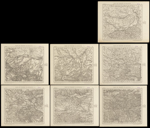
105.
Vereinigte Staaten von Nord-Amerika in 6 blattern, bl. 3
106.
Scattergood's map of sixteen miles around Philadelphia
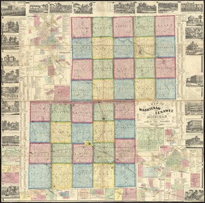
107.
Map of the counties of Washtenaw and Lenawee, Michigan
108.
The United States of America with the British possessions of Canada, Nova Scotia, New Brunwsick, and Newfoundland, divided with...
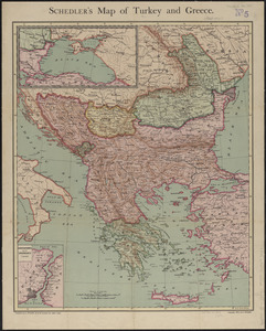
109.
Schedler's map of Turkey and Greece
110.
Atlas of Norfolk County Mass. : from recent and actual surveys & records
111.
Bird's-eye view of the city of Philadelphia : its streets, avenues, and public buildings--and of the Centennial buildings in...
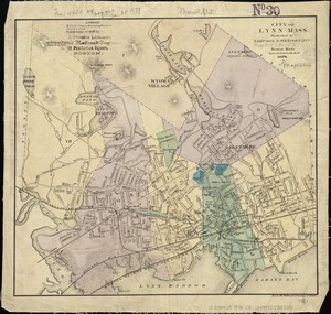
112.
City of Lynn, Mass
113.
County atlas of Berkshire Massachusetts
114.
Eldridge's chart no. 10 : Buzzard's Bay
115.
Index map showing the principal river basins within the state of Massachusetts
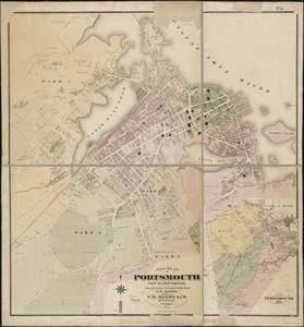
116.
Map of the city of Portsmouth New Hampshire
117.
Map of the South Mountain and Boston Railroad & connections showing territory passed through, rail-roads and canals crossed or...
118.
Map showing horse rail roads and the surface steam roads with 104 stations in and around Boston : including 91 surface steam...
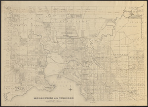
119.
Melbourne and suburbs
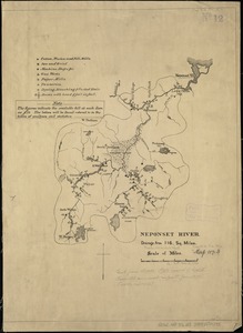
120.
Neponset River
‹ Prev
Next ›
1
2
3
4
5
6
7
8
9

![[Map] of the state of Massachusetts](https://bpldcassets.blob.core.windows.net/derivatives/images/commonwealth:wd376589g/image_thumbnail_300.jpg)