Toggle navigation
LMEC Home
Exhibitions
Georeferencing
Tools for Teachers
Collections
My Favorites
Sign Up / Log In
Search
Search the map portal
Map Collection
Map Collection
Map Sets
Search
Search
Search for
Search In
All Fields
Creator
Title
Subject
Place
Search All Digital Collections
Advanced Search
13385 Results
Filter your Search
Place
North and Central America
9,353
United States
7,078
Suffolk (county)
1,664
Boston
1,621
Europe
1,035
Canada
949
Massachusetts
794
New York
532
more
Place
»
Topic
Boston (Mass.)--Maps
741
City planning--Massachusetts--Boston--Maps
418
United States--History--Revolution, 1775-1783--Maps
329
United States--Maps
315
Urban renewal--Massachusetts--Boston--Maps
254
Real property--Massachusetts--Boston--Maps
252
Massachusetts--Maps
219
Insurance surveys
197
more
Topic
»
Date
Date range begin
–
Date range end
Current results range from
1482
to
2023
View distribution
Creator
United States. Hydrographic Office
595
Boston Redevelopment Authority
403
Des Barres, Joseph F. W. (Joseph Frederick Wallet), 1722-1824
247
Royal United Services Institute for Defence and Security Studies
160
Jefferys, Thomas, -1771
154
George, III, King of Great Britain, 1738-1820
152
George, IV, King of Great Britain, 1762-1830
151
O.H. Bailey & Co
148
more
Creator
»
Format
Maps/Atlases
13,205
Manuscripts
985
Prints
102
Books
49
Drawings/Illustrations
44
Photographs
15
Objects/Artifacts
13
Documents
7
more
Format
»
Georeferenced
Yes
979
No
12,406
Collection
Norman B. Leventhal Map Center Collection
8,891
American Revolutionary War-Era Maps
3,305
Boston and New England Maps
2,804
Urban Maps
2,397
Maritime Charts and Atlases
1,150
William L. Clements Library Collection
910
Library of Congress Collection
618
Boston Redevelopment Authority Collection
475
more
Collection
»
Available to use
No known restrictions
9,952
Creative Commons license
1,677
Search Constraints
Sort by date (desc)
relevance
title
date (asc)
date (desc)
Number of results to display per page
20 per page
10
per page
20
per page
50
per page
100
per page
View results as:
grid view
map view
Search Results
11541.
Plan of New Orleans the capital of Louisiana : with the disposition of its quarters and canals as they have been traced by Mr....
11542.
PLAN of part of FORT GEORGE with the BARRACKS &c Erected in the Year 1759
11543.
A Plan of Pitts Fort at Pittsburgh. Oct.r 1759
11544.
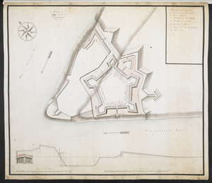
[Plan of proposed Fort Ontario at Oswego]
11545.
A plan of Quebec
11546.
Plan of Quebec, the capital of Canada in North America, with the bason and part of the adjacent contry [sic] shewing the...
11547.
Plan of Quebec, the capital of Canada in North America, with the bason and part of the adjacent contry [sic] shewing the...
11548.
PLAN of the Bastion at Fort George
11549.
Plan of the Battle fought on the Plains of Abraham, September the 13th 1759
11550.
PLAN of the Designed FORT GEORGE at present executing, Shewing its situation and part of its Environs. July the 17.th 1759
11551.
PLAN of the Encampement at Lake George the 27th Iuin 1759
11552.
PLAN of the Encampment Intrenchment with thier Environs at LAKE GEORGE
11553.
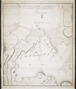
PLAN OF THE ENCAMPMENT OF THE ARMY AT LAKE GEORGE JUNE 1759
11554.
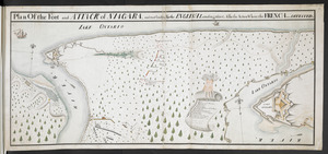
Plan Of the Fort and ATTACK of NIAGARA, and road leading To the ENGLISH Landing place, Also the Action Where the FRENCH were...
11555.
Plan of the fort and fortress at Crown Point with their environs : With the disposition of the English Army under the command...
11556.
PLAN of the FORT in TIENDEROGA and Environs at the head of LAKE CHAMPLAIN November 1759
11557.
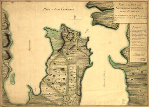
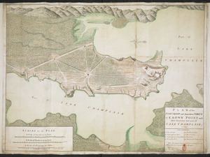
PLAN of the FORTRESS and dependant FORTS at CROWN POINT with their Environs and part of LAKE CHAMPLAIN. 1759
11558.
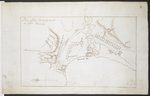
Plan of the Incampement at Fort Edward
11559.
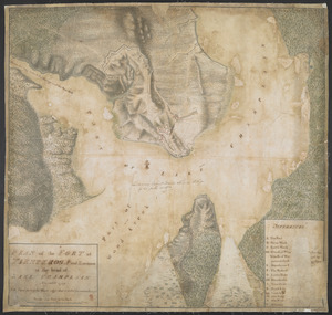
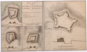
PLAN of the new FORT, and REDOUTS at CROWN POINT, called as below
11560.
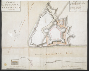
PLAN of the NEW FORT at PITSBURGH November 1759
‹ Prev
Next ›
1
2
…
574
575
576
577
578
579
580
581
582
…
669
670


![[Plan of proposed Fort Ontario at Oswego]](https://bpldcassets.blob.core.windows.net/derivatives/images/commonwealth:hx11z1204/image_thumbnail_300.jpg)

![Plan of Quebec, the capital of Canada in North America, with the bason and part of the adjacent contry [sic] shewing the principal encampments and works of the British Army commanded by Maior General Wolfe and those of the French Army commanded by Lieut. General, the Marquis of Mont Calm during the siege of that place in 1759 [overlay down]](https://bpldcassets.blob.core.windows.net/derivatives/images/commonwealth:q524nd83b/image_thumbnail_300.jpg)
![Plan of Quebec, the capital of Canada in North America, with the bason and part of the adjacent contry [sic] shewing the principal encampments and works of the British Army commanded by Maior General Wolfe and those of the French Army commanded by Lieut. General, the Marquis of Mont Calm during the siege of that place in 1759 [overlay up]](https://bpldcassets.blob.core.windows.net/derivatives/images/commonwealth:q524nd81s/image_thumbnail_300.jpg)