Toggle navigation
LMEC Home
Exhibitions
Georeferencing
Tools for Teachers
Collections
My Favorites
Sign Up / Log In
Search
Search the map portal
Map Collection
Map Collection
Map Sets
Search
Search
Search for
Search In
All Fields
Creator
Title
Subject
Place
Search All Digital Collections
Advanced Search
1485 Results
My Search
Start Over
Subject
"Boston (Mass.)--Maps"
Remove constraint Subject: "Boston (Mass.)--Maps"
Filter your Search
Place
North and Central America
1,484
United States
1,482
Suffolk (county)
1,400
Boston
1,396
Massachusetts
1,100
Boston Harbor
126
Roxbury
91
Charlestown
71
more
Place
»
Topic
Boston (Mass.)--Maps
748
City planning--Massachusetts--Boston--Maps
407
Real property--Massachusetts--Boston--Maps
245
Urban renewal--Massachusetts--Boston--Maps
245
Landowners--Massachusetts--Boston--Maps
161
Buildings--Massachusetts--Boston--Maps
124
Land use--Massachusetts--Boston--Maps
99
Roxbury (Boston, Mass.)--Maps
90
more
Topic
»
Date
Date range begin
–
Date range end
Current results range from
1689
to
2023
View distribution
Creator
Boston Redevelopment Authority
387
Bromley, George Washington
69
Bromley, Walter Scott
68
G.W. Bromley & Co.
46
Geo. H. Walker & Co
28
Boston (Mass.). Engineering Dept
21
Boynton, George W., d. 1884
21
Sampson, Davenport & Co
21
more
Creator
»
Format
Maps/Atlases
1,482
Manuscripts
50
Drawings/Illustrations
5
Posters
1
Prints
1
Georeferenced
Yes
140
No
1,345
Collection
Boston and New England Maps
1,209
Urban Maps
1,016
Norman B. Leventhal Map & Education Center Collection
1,004
Boston Redevelopment Authority Collection
449
American Revolutionary War-Era Maps
129
Mapping Boston Collection
53
Massachusetts Real Estate Atlases
38
Maritime Charts and Atlases
28
more
Collection
»
Available to use
No known restrictions
1,302
Creative Commons license
116
Search Constraints
Sort by relevance
relevance
title
date (asc)
date (desc)
Number of results to display per page
20 per page
10
per page
20
per page
50
per page
100
per page
View results as:
grid view
map view
Search Results
1101.
Boston Harbor, Mass : map of Charles River from Brookline Street bridge to its mouth
1102.
Change in white population (non-Hispanic), 2010 to 2018
1103.
A correct view of the late battle at Charlestown : June 17th, 1775
1104.
Eldridge's new chart no. 4 Boston Harbor : compiled from the latest surveys
1105.
Extract from the plan of the coast survey of Boston Harbor, 1847
1106.
Map of Boston Harbor : showing commissioners' lines, wharves &c
1107.
Plan for the occupation of flats owned by the Commonwealth in Boston Harbor
1108.
Plan of main ship channel in Boston Harbor showing the work of removing certain obstructions to navigation
1109.
Plan showing encroachments upon the inner basins of Boston Harbor : accompanying annual report of Harbor and Land...
1110.
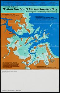
Science & policy of Boston Harbor symposium poster
1111.
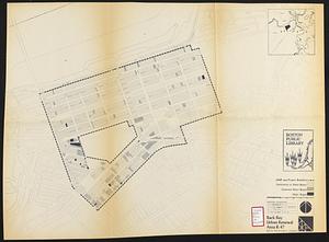
Back Bay project no. Mass R-47
1112.
Back Bay urban renewal area r-47 : land use plan
1113.
Back Bay urban renewal area r-47 : building conditions
1114.
Back Bay urban renewal area r-47 : building conditions
1115.
Back Bay urban renewal area r-47 : building conditions
1116.
Campus High School urban renewal area Mass. r- : existing land use
1117.
Campus High School urban renewal area Mass. r-129 : proposed land-use
1118.
Campus High School urban renewal area Mass. r-129 : property map
1119.
Campus High School urban renewal area Mass. r-129 : disposition parcels
1120.
Campus High School urban renewal area Mass. r-129 : existing land-use
‹ Prev
Next ›
1
2
…
52
53
54
55
56
57
58
59
60
…
74
75