Toggle navigation
LMEC Home
Exhibitions
Georeferencing
Tools for Teachers
Collections
My Favorites
Sign Up / Log In
Search
Search the map portal
Map Collection
Map Collection
Map Sets
Search
Search
Search for
Search In
All Fields
Creator
Title
Subject
Place
Search All Digital Collections
Advanced Search
13385 Results
Filter your Search
Place
North and Central America
9,353
United States
7,286
Suffolk (county)
1,664
Boston
1,621
Europe
1,035
Canada
949
Massachusetts
875
New York
534
more
Place
»
Topic
Boston (Mass.)--Maps
741
City planning--Massachusetts--Boston--Maps
418
United States--History--Revolution, 1775-1783--Maps
329
United States--Maps
315
Urban renewal--Massachusetts--Boston--Maps
254
Real property--Massachusetts--Boston--Maps
252
Massachusetts--Maps
219
Insurance surveys
197
more
Topic
»
Date
Date range begin
–
Date range end
Current results range from
1482
to
2023
View distribution
Creator
United States. Hydrographic Office
595
Boston Redevelopment Authority
403
Des Barres, Joseph F. W. (Joseph Frederick Wallet), 1722-1824
247
Royal United Services Institute for Defence and Security Studies
160
Jefferys, Thomas, -1771
154
George, III, King of Great Britain, 1738-1820
152
George, IV, King of Great Britain, 1762-1830
151
O.H. Bailey & Co
148
more
Creator
»
Format
Maps/Atlases
13,205
Manuscripts
985
Prints
102
Books
49
Drawings/Illustrations
44
Photographs
15
Objects/Artifacts
13
Documents
7
more
Format
»
Georeferenced
Yes
979
No
12,406
Collection
Norman B. Leventhal Map Center Collection
8,891
American Revolutionary War-Era Maps
3,305
Boston and New England Maps
2,804
Urban Maps
2,397
Maritime Charts and Atlases
1,150
William L. Clements Library Collection
910
Library of Congress Collection
618
Boston Redevelopment Authority Collection
475
more
Collection
»
Available to use
No known restrictions
9,952
Creative Commons license
1,677
Search Constraints
Sort by date (desc)
relevance
title
date (asc)
date (desc)
Number of results to display per page
20 per page
10
per page
20
per page
50
per page
100
per page
View results as:
grid view
map view
Search Results
10301.
Frederick Bay ... : Ramsheg Harbour ... Pictou Harbour ... Port Luttrell
10302.
Die gegend um Boston
10303.
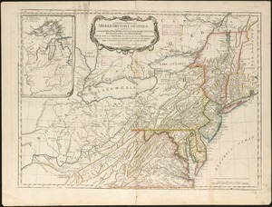
A general map of the middle British colonies, in America : containing Virginia, Maryland, the Delaware counties, Pennsylvania...
10304.
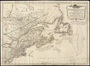
A general map of the northern British colonies in America : which comprehends the province of Quebec, the government of...
10305.
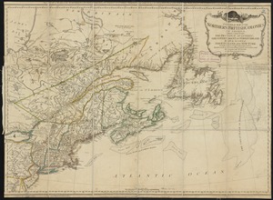
A general map of the northern British Colonies in America : which comprehends the province of Quebec, the government of...
10306.
A general map of the southern British colonies in America comprehending North and South Carolina, Georgia, East and West...
10307.
George's Island in Halifax harbor, Nova Scotia
10308.
The Gut of Canso : which divides ... cables distance
10309.
Halifax Harbour ... Catch Harbour ... small vessels only
10310.
King's Bay ... : Lunenburg
10311.
Map of British outposts between Burlington and New Bridge, New Jersey, December 1776
10312.
A Map of Connecticut and Rhode Island, with Long Island Sound, &c
10313.
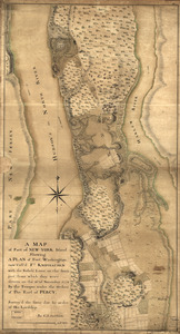
A map of part of New-York Island showing a plan of Fort Washington : now call'd Ft. Kniphausen with the rebels lines on the...
10314.
A map of the British empire, in North America
10315.
Map of the country between and bordering the Delaware River and Chesapeake Bay : showing roads to Philadelphia and localities
10316.
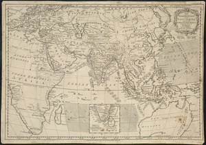
Map of the European settlements in the East Indies and on the eastern coast of Africa including part of Europe
10317.
A map of the middle British colonies in North America : first published by Mr. Lewis Evans, of Philadelphia, in 1755; and since...
10318.
A map of the middle British colonies in North America : first published by Mr. Lewis Evans, of Philadelphia, in 1755; and since...
10319.
A map of the most inhabited part of New England, containing the provinces of Massachusets Bay and New Hampshire, with the...
10320.
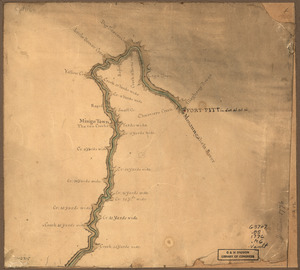
Map of the Ohio River from Fort Pitt
‹ Prev
Next ›
1
2
…
512
513
514
515
516
517
518
519
520
…
669
670