Toggle navigation
LMEC Home
Exhibitions
Georeferencing
Tools for Teachers
Collections
My Favorites
Sign Up / Log In
Search
Search the map portal
Map Collection
Map Collection
Map Sets
Search
Search
Search for
Search In
All Fields
Creator
Title
Subject
Place
Search All Digital Collections
Advanced Search
14164 Results
Filter your Search
Place
North and Central America
10,832
United States
8,868
Massachusetts
2,832
Suffolk (county)
1,688
Boston
1,644
Europe
1,428
Canada
1,010
New York
684
more
Place
»
Topic
Boston (Mass.)--Maps
753
City planning--Massachusetts--Boston--Maps
419
United States--History--Revolution, 1775-1783--Maps
331
United States--Maps
331
Real property--Massachusetts--Boston--Maps
254
Urban renewal--Massachusetts--Boston--Maps
254
North America--Maps--Early works to 1800
241
Massachusetts--Maps
236
more
Topic
»
Date
Date range begin
–
Date range end
Current results range from
1482
to
2023
View distribution
Creator
United States. Hydrographic Office
597
Boston Redevelopment Authority
404
Des Barres, Joseph F. W. (Joseph Frederick Wallet), 1722-1824
247
Jefferys, Thomas, -1771
172
United States. National Ocean Service
170
Royal United Services Institute for Defence and Security Studies
160
George, III, King of Great Britain, 1738-1820
152
George, IV, King of Great Britain, 1762-1830
151
more
Creator
»
Format
Maps/Atlases
13,978
Manuscripts
985
Prints
102
Books
53
Drawings/Illustrations
44
Photographs
15
Objects/Artifacts
13
Documents
7
more
Format
»
Georeferenced
Yes
979
No
13,185
Collection
Norman B. Leventhal Map & Education Center Collection
9,162
American Revolutionary War-Era Maps
3,629
Boston and New England Maps
2,936
Urban Maps
2,511
Maritime Charts and Atlases
1,169
William L. Clements Library Collection
910
Library of Congress Collection
618
Boston Redevelopment Authority Collection
475
more
Collection
»
Available to use
No known restrictions
10,408
Creative Commons license
1,678
Search Constraints
Sort by relevance
relevance
title
date (asc)
date (desc)
Number of results to display per page
20 per page
10
per page
20
per page
50
per page
100
per page
View results as:
grid view
map view
Search Results
10161.
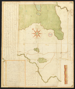
Plan of Standish, made by Moses Banks, dated February 23, 1795.
10162.
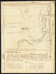
Plan of Starks, made by Samuel Weston, dated April 15, 1798.
10163.
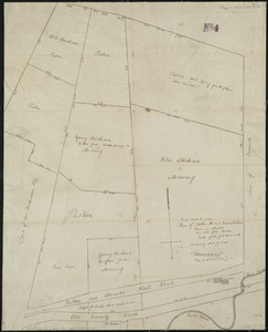
Plan of Stephen W. and Francis Jackson's farm in Newton, 6 1/2 miles from Boston
10164.
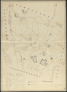
Plan of Sterling made by Moses Sawyer, dated 1830
10165.
Plan of Sterling, surveyor's name not given, dated May 22, 1795.
10166.
Plan of Steuben surveyed by Osgood Carleton, dated 1794-5.
10167.
Plan of Stockbridge, surveyor's name not given, dated 1830
10168.
Plan of Stockbridge, surveyor's name not given, dated May 25, 1795.
10169.
Plan of Stoneham made by John G. Hales, dated September 1830
10170.
Plan of Stoneham surveyed by Luther Richardson, dated November 1794.
10171.
Plan of store lots near Haymarket Square : belonging to the estate of Josiah Quincy Jr. : to be sold by public auction on...
10172.
Plan of Stoughton made by Joseph Hodges, dated October 1830
10173.
Plan of Stoughton surveyed by Nathaniel Fisher, dated 1794.
10174.
Plan of Stow made by Augustus Tower, dated 1830
10175.
Plan of Stow surveyed by Jabez Brown, dated October 1794.
10176.
Plan of Strong, ME (Township No.3), surveyor's name not given, dated December 10, 1795.
10177.
Plan of Sturbridge made by David Wright, dated October 1831
10178.
Plan of Sturbridge surveyed by Job Hamant, dated May 6, 1795.
10179.
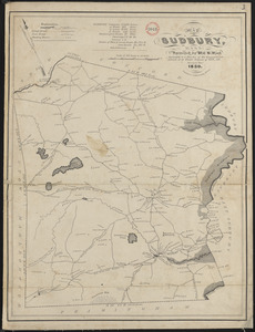
Plan of Sudbury made by William H. Wood, dated October 1830
10180.
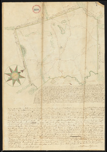
Plan of Sudbury surveyed by Matthias Mossman, dated April 17, 1795.
‹ Prev
Next ›
1
2
…
505
506
507
508
509
510
511
512
513
…
708
709