Toggle navigation
LMEC Home
Exhibitions
Georeferencing
Tools for Teachers
Collections
My Favorites
Sign Up / Log In
Search
Search the map portal
Map Collection
Map Collection
Map Sets
Search
Search
Search for
Search In
All Fields
Creator
Title
Subject
Place
Search All Digital Collections
Advanced Search
14021 Results
Filter your Search
Place
North and Central America
10,683
United States
8,692
Massachusetts
2,808
Suffolk (county)
1,682
Boston
1,638
Europe
1,420
Canada
1,009
New York
674
more
Place
»
Topic
Boston (Mass.)--Maps
748
City planning--Massachusetts--Boston--Maps
418
United States--History--Revolution, 1775-1783--Maps
331
United States--Maps
328
Real property--Massachusetts--Boston--Maps
254
Urban renewal--Massachusetts--Boston--Maps
254
North America--Maps--Early works to 1800
240
Massachusetts--Maps
234
more
Topic
»
Date
Date range begin
–
Date range end
Current results range from
1482
to
2023
View distribution
Creator
United States. Hydrographic Office
597
Boston Redevelopment Authority
404
Des Barres, Joseph F. W. (Joseph Frederick Wallet), 1722-1824
247
Jefferys, Thomas, -1771
172
Royal United Services Institute for Defence and Security Studies
160
George, III, King of Great Britain, 1738-1820
152
George, IV, King of Great Britain, 1762-1830
151
O.H. Bailey & Co
148
more
Creator
»
Format
Maps/Atlases
13,839
Manuscripts
985
Prints
102
Books
49
Drawings/Illustrations
44
Photographs
15
Objects/Artifacts
13
Documents
7
more
Format
»
Georeferenced
Yes
979
No
13,042
Collection
Norman B. Leventhal Map & Education Center Collection
9,110
American Revolutionary War-Era Maps
3,627
Boston and New England Maps
2,921
Urban Maps
2,480
Maritime Charts and Atlases
1,169
William L. Clements Library Collection
910
Library of Congress Collection
618
Boston Redevelopment Authority Collection
475
more
Collection
»
Available to use
No known restrictions
10,268
Creative Commons license
1,678
Search Constraints
Sort by relevance
relevance
title
date (asc)
date (desc)
Number of results to display per page
20 per page
10
per page
20
per page
50
per page
100
per page
View results as:
grid view
map view
Search Results
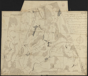
8981.
Plan of Ashburnham surveyed by Matthias Mossman, dated 1794-5.
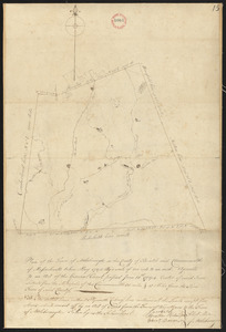
8982.
Plan of Ashburnham, surveyor's name not given, dated October, 1830
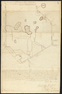
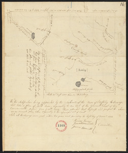
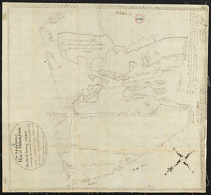
8983.
Plan of Ashby, surveyor's name not given , dated 1794.
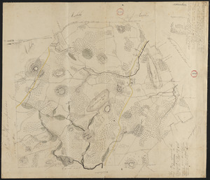
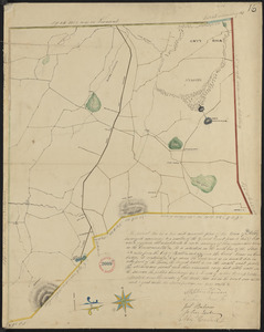
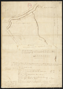
8984.
Plan of Ashby, surveyor's name not given, dated 1830
8985.
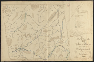
Plan of Ashfield made by Levi Leonard, dated December 25, 1830
8986.
Plan of Ashfield, surveyor's name not given, dated May 27, 1795.
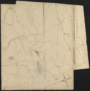
8987.
Plan of Athol, surveyor's name not given, dated April 27, 1795.
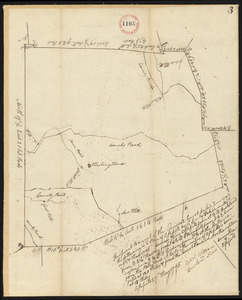
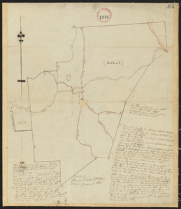
8988.
Plan of Athol, surveyor's name not given, dated September 1830
8989.
Plan of Attleborough made by Joseph W. Capron, dated March, 1831
8990.
Plan of Attleborough, surveyor's name not given, dated May, 1795.
8991.
Plan of Back Bay and vicinity : prepared from surveys made under the direction of Simon Greenleaf, Joel Giles, Ezra Lincoln,...
8992.
Plan of Back Bay showing improvements on streets and estates
8993.
Plan of Bahía Honda ; Plan of Puerto de Cavañas
8994.
Plan of Bahia Xagua on the south side of Cuba ; Plan of the Colorado Rocks, near the west end of Cuba
8995.
Plan of Ballstown (Jefferson and Whitefield) surveyed by William Davis, dated May 20, 1795.
8996.
Plan of Bangor made by Elihu Warner, dated October 20, 1795.
8997.
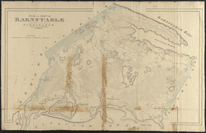
Plan of Barnstable made by John G. Hales, dated 1831
8998.
Plan of Barnstable surveyed by Samuel Basset, dated May, 1795.
8999.
Plan of Barre made by David Lee and Samuel Lee, dated June 1830
9000.
Plan of Barre surveyor's name not given, dated December, 1794.
‹ Prev
Next ›
1
2
…
446
447
448
449
450
451
452
453
454
…
701
702