Toggle navigation
LMEC Home
Exhibitions
Georeferencing
Tools for Teachers
Collections
My Favorites
Sign Up / Log In
Search
Search the map portal
Map Collection
Map Collection
Map Sets
Search
Search
Search for
Search In
All Fields
Creator
Title
Subject
Place
Search All Digital Collections
Advanced Search
13680 Results
My Search
Start Over
Date facet yearly ssim
1580
to
1584
Remove constraint Date facet yearly ssim: <span class='from'>1580</span> to <span class='to'>1584</span>
Filter your Search
Place
North and Central America
10,344
United States
8,475
Massachusetts
2,789
Suffolk (county)
1,677
Boston
1,633
Europe
1,415
Canada
950
New York
649
more
Place
»
Topic
Boston (Mass.)--Maps
747
City planning--Massachusetts--Boston--Maps
418
United States--History--Revolution, 1775-1783--Maps
329
United States--Maps
322
Real property--Massachusetts--Boston--Maps
254
Urban renewal--Massachusetts--Boston--Maps
254
Massachusetts--Maps
231
Insurance surveys
197
more
Topic
»
Date
Date range begin
–
Date range end
Current results range from
1482
to
2023
View distribution
Creator
United States. Hydrographic Office
597
Boston Redevelopment Authority
404
Des Barres, Joseph F. W. (Joseph Frederick Wallet), 1722-1824
247
Royal United Services Institute for Defence and Security Studies
160
Jefferys, Thomas, -1771
154
George, III, King of Great Britain, 1738-1820
152
George, IV, King of Great Britain, 1762-1830
151
O.H. Bailey & Co
148
more
Creator
»
Format
Maps/Atlases
13,499
Manuscripts
985
Prints
102
Books
49
Drawings/Illustrations
44
Photographs
15
Objects/Artifacts
13
Documents
7
more
Format
»
Georeferenced
Yes
979
No
12,701
Collection
Norman B. Leventhal Map & Education Center Collection
9,096
American Revolutionary War-Era Maps
3,305
Boston and New England Maps
2,915
Urban Maps
2,471
Maritime Charts and Atlases
1,169
William L. Clements Library Collection
910
Library of Congress Collection
618
Boston Redevelopment Authority Collection
475
more
Collection
»
Available to use
No known restrictions
10,246
Creative Commons license
1,678
Search Constraints
Sort by relevance
relevance
title
date (asc)
date (desc)
Number of results to display per page
20 per page
10
per page
20
per page
50
per page
100
per page
View results as:
grid view
map view
Search Results
8781.
Plan of Boston
8782.
Plan of Boston
8783.
Plan of Boston
8784.
Plan of Boston
8785.
Plan of Boston & Maine Railroad terminal division Boston, Cambridge, Somerville, Everett and Medford
8786.
Plan of Boston & vicinity
8787.
Plan of Boston 1828
8788.
A Plan of Boston, and its environs. : Shewing the true situation of His Majesty's army. And also those of the rebels
8789.
A plan of Boston, and its environs : shewing the true situation of His Majesty's army, and also those of the rebels
8790.
A plan of Boston, and its environs : shewing the true situation of His Majesty's army, and also those of the rebels
8791.
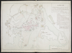
A PLAN of BOSTON and its Environs shewing the true Situation of His Majesty's Troops, and also those of the Rebels; likewise...
8792.
Plan of Boston and its vicinity
8793.
Plan of Boston and its vicinity
8794.
Plan of Boston and its vicinity
8795.
Plan of Boston and its vicinity showing the connection of the Grand Junction Rail Road with the Harbor and other Rail-roads
8796.
Plan of Boston and its vicinity, showing the drainage area of Stony Brook which empties into the full basin of the Back Bay
8797.
Plan of Boston and its vicinity, showing the drainage area of Stony Brook which empties into the full basin of the Back Bay
8798.
Plan of Boston and Roxbury
8799.
Plan of Boston comprising a part of Charlestown and Cambridge
8800.
Plan of Boston comprising a part of Charlestown and Cambridge
‹ Prev
Next ›
1
2
…
436
437
438
439
440
441
442
443
444
…
683
684