Toggle navigation
LMEC Home
Exhibitions
Georeferencing
Tools for Teachers
Collections
My Favorites
Sign Up / Log In
Search
Search the map portal
Map Collection
Map Collection
Map Sets
Search
Search
Search for
Search In
All Fields
Creator
Title
Subject
Place
Search All Digital Collections
Advanced Search
14021 Results
Filter your Search
Place
North and Central America
10,683
United States
8,692
Massachusetts
2,808
Suffolk (county)
1,682
Boston
1,638
Europe
1,420
Canada
1,009
New York
674
more
Place
»
Topic
Boston (Mass.)--Maps
748
City planning--Massachusetts--Boston--Maps
418
United States--History--Revolution, 1775-1783--Maps
331
United States--Maps
328
Real property--Massachusetts--Boston--Maps
254
Urban renewal--Massachusetts--Boston--Maps
254
North America--Maps--Early works to 1800
240
Massachusetts--Maps
234
more
Topic
»
Date
Date range begin
–
Date range end
Current results range from
1482
to
2023
View distribution
Creator
United States. Hydrographic Office
597
Boston Redevelopment Authority
404
Des Barres, Joseph F. W. (Joseph Frederick Wallet), 1722-1824
247
Jefferys, Thomas, -1771
172
Royal United Services Institute for Defence and Security Studies
160
George, III, King of Great Britain, 1738-1820
152
George, IV, King of Great Britain, 1762-1830
151
O.H. Bailey & Co
148
more
Creator
»
Format
Maps/Atlases
13,839
Manuscripts
985
Prints
102
Books
49
Drawings/Illustrations
44
Photographs
15
Objects/Artifacts
13
Documents
7
more
Format
»
Georeferenced
Yes
979
No
13,042
Collection
Norman B. Leventhal Map & Education Center Collection
9,110
American Revolutionary War-Era Maps
3,627
Boston and New England Maps
2,921
Urban Maps
2,480
Maritime Charts and Atlases
1,169
William L. Clements Library Collection
910
Library of Congress Collection
618
Boston Redevelopment Authority Collection
475
more
Collection
»
Available to use
No known restrictions
10,268
Creative Commons license
1,678
Search Constraints
Sort by relevance
relevance
title
date (asc)
date (desc)
Number of results to display per page
20 per page
10
per page
20
per page
50
per page
100
per page
View results as:
grid view
map view
Search Results
8681.
Plan and section, Montague gold district, Halifax Co., Nova Scotia
8682.
Plan and section, Mooseland gold district, Halifax co., N.S
8683.
Plan and section, Mount Uniacke gold district, Hants Co., Nova Scotia
8684.
A plan and section of the two routs in Woburn, say 1795 : Middlesex Canal
8685.
Plan and section, Salmon River gold district, Halifax Co., N.S
8686.
Plan and section, South Uniacke gold district, Hants and Halifax Counties, Nova Scotia
8687.
Plan and section, Tangier gold district, Halifax Co., Nova Scotia
8688.
Plan and sections, Brookfield gold district, Queens Co., Nova Scotia
8689.
Plan and sections, Caribou gold district, Halifax Co., N.S
8690.
Plan and sections Harrigan Cove gold district, Halifax Co., Nova Scotia
8691.
Plan and sections Isaacs Harbour gold district, Guysborough Co., Nova Scotia
8692.
Plan and sections Malaga gold district, Queens Co., Nova-Scotia
8693.
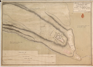
PLAN and SECTIONS of Cumberland Hill Showing the Situation of FORT CUMBERLAND Upon the Isthmus of NOVA SCOTIA
8694.
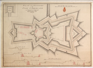
PLAN and SECTIONS of FORT CUMBERLAND As Proposed to be Repaired
8695.
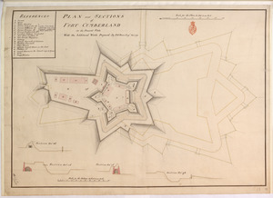
PLAN and SECTIONS of FORT CUMBERLAND in its Present State With the Additional Works Proposed
8696.
Plan and sections of Fort Fisher, carried by assault by the U.S. forces, Maj. Gen. A.H. Terry commanding, Jan. 15th, 1865
8697.
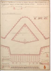
PLAN and SECTIONS of the Front of the Projected Hornwork at FORT CUMBERLAND with CASEMATES Proposed in the Curtain Capable of...
8698.
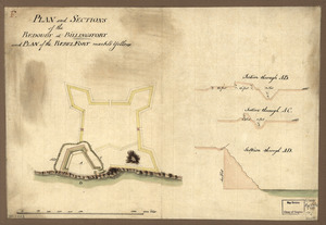
Plan and sections of the redoubt at Billingsfort and plan of the rebel fort marked yellow
8699.
Plan and sections, Oldham gold district, Halifax Co., N.S
8700.
Plan and sections Renerew gold district, Hants Co. Nova Scotia
‹ Prev
Next ›
1
2
…
431
432
433
434
435
436
437
438
439
…
701
702