Toggle navigation
LMEC Home
Exhibitions
Georeferencing
Tools for Teachers
Collections
My Favorites
Sign Up / Log In
Search
Search the map portal
Map Collection
Map Collection
Map Sets
Search
Search
Search for
Search In
All Fields
Creator
Title
Subject
Place
Search All Digital Collections
Advanced Search
13518 Results
My Search
Start Over
Date facet yearly ssim
1829
Remove constraint Date facet yearly ssim: <span class='single'>1829</span>
Filter your Search
Place
North and Central America
10,232
United States
8,367
Massachusetts
2,778
Suffolk (county)
1,675
Boston
1,631
Europe
1,386
Canada
949
New York
640
more
Place
»
Topic
Boston (Mass.)--Maps
746
City planning--Massachusetts--Boston--Maps
418
United States--History--Revolution, 1775-1783--Maps
329
United States--Maps
321
Real property--Massachusetts--Boston--Maps
254
Urban renewal--Massachusetts--Boston--Maps
254
Massachusetts--Maps
230
Insurance surveys
197
more
Topic
»
Date
Date range begin
–
Date range end
Current results range from
1482
to
2023
View distribution
Creator
United States. Hydrographic Office
596
Boston Redevelopment Authority
404
Des Barres, Joseph F. W. (Joseph Frederick Wallet), 1722-1824
247
Royal United Services Institute for Defence and Security Studies
160
Jefferys, Thomas, -1771
154
George, III, King of Great Britain, 1738-1820
152
George, IV, King of Great Britain, 1762-1830
151
O.H. Bailey & Co
148
more
Creator
»
Format
Maps/Atlases
13,337
Manuscripts
985
Prints
102
Books
49
Drawings/Illustrations
44
Photographs
15
Objects/Artifacts
13
Documents
7
more
Format
»
Georeferenced
Yes
979
No
12,539
Collection
Norman B. Leventhal Map & Education Center Collection
9,022
American Revolutionary War-Era Maps
3,305
Boston and New England Maps
2,900
Urban Maps
2,425
Maritime Charts and Atlases
1,167
William L. Clements Library Collection
910
Library of Congress Collection
618
Boston Redevelopment Authority Collection
475
more
Collection
»
Available to use
No known restrictions
10,085
Creative Commons license
1,677
Search Constraints
Sort by relevance
relevance
title
date (asc)
date (desc)
Number of results to display per page
20 per page
10
per page
20
per page
50
per page
100
per page
View results as:
grid view
map view
Search Results
8401.
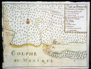
Plan de Pensacolle
8402.
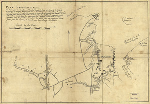
Plan de Portsmouth en Virginie
8403.
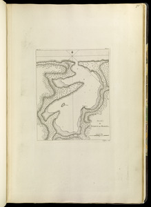
Plan de Puerto de Mariel
8404.
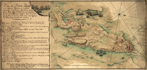
Plan de Rhode Island et les differentes operations de la flotte-françoises et des troupes americaines : commandées par le...
8405.
Plan de Rhode Islande, les differentes operations de la flotte françoise et des trouppes Américaines commandeés par le major...
8406.
Plan de Rhodes-Island, et position de l'armée françoise a Newport
8407.
Plan de Rome
8408.
Plan de Savannah
8409.
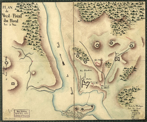
Plan de West-Point du nord, levé a vue
8410.
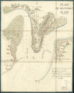
Plan de West-Point du Sud
8411.
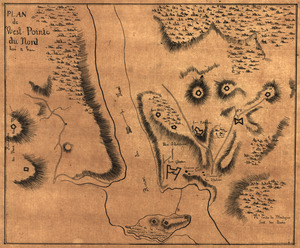
Plan de West-Pointe du nord levé a vue
8412.
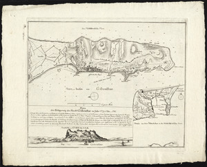
Plan der belagerung der stadt Gibraltar im jahr 1779, 1780, 1781
8413.
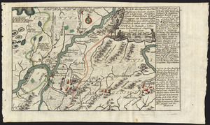
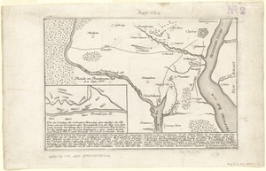
Plan der gegend des Ohio Flusses, wo ohnweit da von am 9 July 1755, zwischen denen Franzofichen u. Engl trouppen ein hiziges...
8414.
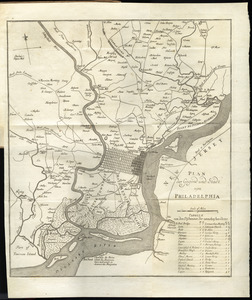
Plan der gegend und stadt von Philadelphia
8415.
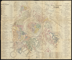
Plan der k.k. haupt- und residenzstadt Wien
8416.
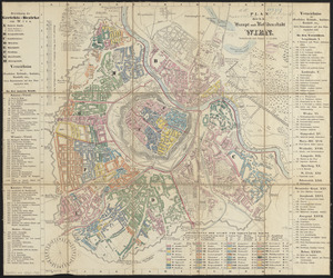
Plan der k.k. haupt- und residenzstadt Wien
8417.
Plan der landung der Gebrüdere Howe, bey dem ausfluss des Elk Strom ...Lords Cornwallis
8418.
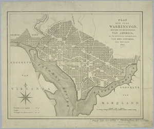
Plan der stad Washington : bestemd tot de hoofdstad van America, en ter bestendige verblijfplaats van het Congres, naa het jaar...
8419.
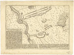
Plan des befestigten lagers der Amerikaner bey Whitemarsh
8420.
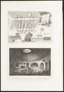
Plan des catacombes de Syracuse ; intérieur d'une des chambres sépulcrales des catacombes
‹ Prev
Next ›
1
2
…
417
418
419
420
421
422
423
424
425
…
675
676