Toggle navigation
LMEC Home
Exhibitions
Georeferencing
Tools for Teachers
Collections
My Favorites
Sign Up / Log In
Search
Search the map portal
Map Collection
Map Collection
Map Sets
Search
Search
Search for
Search In
All Fields
Creator
Title
Subject
Place
Search All Digital Collections
Advanced Search
13385 Results
My Search
Start Over
Date facet yearly ssim
1800
to
1849
Remove constraint Date facet yearly ssim: <span class='from'>1800</span> to <span class='to'>1849</span>
Filter your Search
Place
North and Central America
9,353
United States
7,286
Suffolk (county)
1,664
Boston
1,621
Europe
1,035
Canada
949
Massachusetts
806
New York
534
more
Place
»
Topic
Boston (Mass.)--Maps
741
City planning--Massachusetts--Boston--Maps
418
United States--History--Revolution, 1775-1783--Maps
329
United States--Maps
315
Urban renewal--Massachusetts--Boston--Maps
254
Real property--Massachusetts--Boston--Maps
252
Massachusetts--Maps
219
Insurance surveys
197
more
Topic
»
Date
Date range begin
–
Date range end
Current results range from
1482
to
2023
View distribution
Creator
United States. Hydrographic Office
595
Boston Redevelopment Authority
403
Des Barres, Joseph F. W. (Joseph Frederick Wallet), 1722-1824
247
Royal United Services Institute for Defence and Security Studies
160
Jefferys, Thomas, -1771
154
George, III, King of Great Britain, 1738-1820
152
George, IV, King of Great Britain, 1762-1830
151
O.H. Bailey & Co
148
more
Creator
»
Format
Maps/Atlases
13,205
Manuscripts
985
Prints
102
Books
49
Drawings/Illustrations
44
Photographs
15
Objects/Artifacts
13
Documents
7
more
Format
»
Georeferenced
Yes
979
No
12,406
Collection
Norman B. Leventhal Map Center Collection
8,891
American Revolutionary War-Era Maps
3,305
Boston and New England Maps
2,804
Urban Maps
2,397
Maritime Charts and Atlases
1,150
William L. Clements Library Collection
910
Library of Congress Collection
618
Boston Redevelopment Authority Collection
475
more
Collection
»
Available to use
No known restrictions
9,952
Creative Commons license
1,677
Search Constraints
Sort by relevance
relevance
title
date (asc)
date (desc)
Number of results to display per page
20 per page
10
per page
20
per page
50
per page
100
per page
View results as:
grid view
map view
Search Results
821.
Back Bay park
822.
Back Bay project no. Mass R-47
823.
Back Bay project no. Mass. R-47 : police signal system, fire alarm system and M.T.A. facilities
824.
Back Bay study
825.
Back Bay study landscape plan
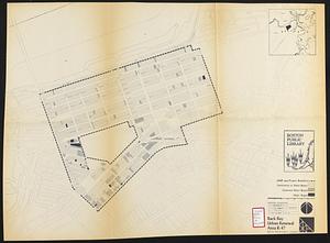
826.
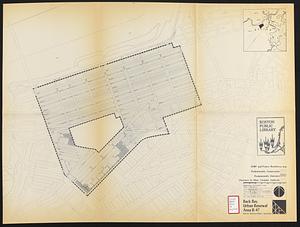
Back Bay urban renewal area r-47 : existing land use
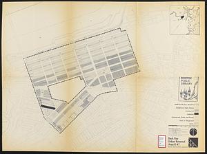
827.
Back Bay urban renewal area r-47 : land use plan
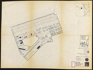
828.
Back Bay urban renewal area r-47 : building conditions
829.
Back Bay urban renewal area r-47 : existing land use
830.
Back Bay urban renewal area r-47 : building conditions
831.
Back Bay urban renewal area r-47 : community facilities & circulation plan
832.
Back Bay urban renewal area r-47 : land use plan
833.
Back Bay urban renewal area r-47 : existing circulation
834.
Back Bay urban renewal area r-47 : proposed land use
835.
Back Bay urban renewal area r-47 : existing land use
836.
Back Bay urban renewal area r-47 : building conditions
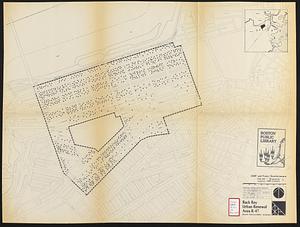
837.
Back Bay urban renewal area r-47 : existing population density
838.
Back Bay urban renewal area r-47 : proposed treatment and title 1 projects
839.
Back Bay urban renewal area r-47 : existing and proposed community facilities
840.
Back Bay view of the world
‹ Prev
Next ›
1
2
…
38
39
40
41
42
43
44
45
46
…
669
670