Toggle navigation
LMEC Home
Exhibitions
Georeferencing
Tools for Teachers
Collections
My Favorites
Sign Up / Log In
Search
Search the map portal
Map Collection
Map Collection
Map Sets
Search
Search
Search for
Search In
All Fields
Creator
Title
Subject
Place
Search All Digital Collections
Advanced Search
13680 Results
My Search
Start Over
Date facet yearly ssim
1849
Remove constraint Date facet yearly ssim: <span class='single'>1849</span>
Filter your Search
Place
North and Central America
10,344
United States
8,475
Massachusetts
2,789
Suffolk (county)
1,677
Boston
1,633
Europe
1,415
Canada
950
New York
649
more
Place
»
Topic
Boston (Mass.)--Maps
747
City planning--Massachusetts--Boston--Maps
418
United States--History--Revolution, 1775-1783--Maps
329
United States--Maps
322
Real property--Massachusetts--Boston--Maps
254
Urban renewal--Massachusetts--Boston--Maps
254
Massachusetts--Maps
231
Insurance surveys
197
more
Topic
»
Date
Date range begin
–
Date range end
Current results range from
1482
to
2023
View distribution
Creator
United States. Hydrographic Office
597
Boston Redevelopment Authority
404
Des Barres, Joseph F. W. (Joseph Frederick Wallet), 1722-1824
247
Royal United Services Institute for Defence and Security Studies
160
Jefferys, Thomas, -1771
154
George, III, King of Great Britain, 1738-1820
152
George, IV, King of Great Britain, 1762-1830
151
O.H. Bailey & Co
148
more
Creator
»
Format
Maps/Atlases
13,499
Manuscripts
985
Prints
102
Books
49
Drawings/Illustrations
44
Photographs
15
Objects/Artifacts
13
Documents
7
more
Format
»
Georeferenced
Yes
979
No
12,701
Collection
Norman B. Leventhal Map & Education Center Collection
9,096
American Revolutionary War-Era Maps
3,305
Boston and New England Maps
2,915
Urban Maps
2,471
Maritime Charts and Atlases
1,169
William L. Clements Library Collection
910
Library of Congress Collection
618
Boston Redevelopment Authority Collection
475
more
Collection
»
Available to use
No known restrictions
10,246
Creative Commons license
1,678
Search Constraints
Sort by relevance
relevance
title
date (asc)
date (desc)
Number of results to display per page
20 per page
10
per page
20
per page
50
per page
100
per page
View results as:
grid view
map view
Search Results
8321.
Philips' new map of Central Europe
8322.
Philip's new plan of London
8323.
Philips Radio
8324.
Philips' sketch map of the Klondike gold region, Yukon district, Dominion of Canada : compiled from the latest authentic...
8325.
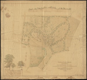
Phillips Academy, Andover, Mass. : plan for development of lands lying between Bartlett, Morton and Highland Sts.
8326.
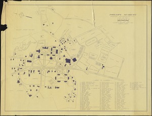
Phillips Academy, Andover, Massachusetts
8327.
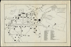
Phillips Academy, Andover, Massachusetts, map of property
8328.
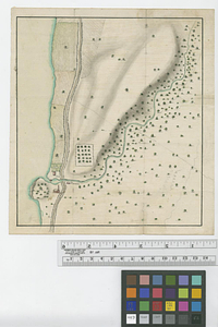
Phillipse Manor
8329.
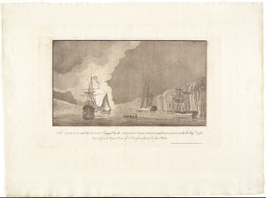
The Phoenix and the Rose engaged by the enemy's fire ships and galleys on the 16 Augst. 1776
8330.
Photo relief map of England
8331.
Photo relief map of Europe
8332.
Photo relief map of Scotland
8333.
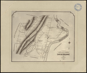
Photographic plan of Ireland (Third) Parish, Springfield, now city of Holyoke, showing residences and names of residents, made...
8334.
Physical geography with the boundaries of ancient China
8335.
Physical map of Germany
8336.
Physical map of the Crimea, with enlarged maps of the seat of war and views of Sebastopol & Balaklava
8337.
Physical map of the world, April 2001
8338.
Physiographic diagram of Europe
8339.
Physiographical map of North Carolina
8340.
Pianta della campagna Romana nello stato antico e moderno
‹ Prev
Next ›
1
2
…
413
414
415
416
417
418
419
420
421
…
683
684