Toggle navigation
LMEC Home
Exhibitions
Georeferencing
Tools for Teachers
Collections
My Favorites
Sign Up / Log In
Search
Search the map portal
Map Collection
Map Collection
Map Sets
Search
Search
Search for
Search In
All Fields
Creator
Title
Subject
Place
Search All Digital Collections
Advanced Search
13385 Results
My Search
Start Over
Date facet yearly ssim
1665
to
1669
Remove constraint Date facet yearly ssim: <span class='from'>1665</span> to <span class='to'>1669</span>
Filter your Search
Place
North and Central America
10,111
United States
8,249
Massachusetts
2,691
Suffolk (county)
1,664
Boston
1,621
Europe
1,386
Canada
949
New York
640
more
Place
»
Topic
Boston (Mass.)--Maps
741
City planning--Massachusetts--Boston--Maps
418
United States--History--Revolution, 1775-1783--Maps
329
United States--Maps
315
Urban renewal--Massachusetts--Boston--Maps
254
Real property--Massachusetts--Boston--Maps
252
Massachusetts--Maps
219
Insurance surveys
197
more
Topic
»
Date
Date range begin
–
Date range end
Current results range from
1482
to
2023
View distribution
Creator
United States. Hydrographic Office
595
Boston Redevelopment Authority
403
Des Barres, Joseph F. W. (Joseph Frederick Wallet), 1722-1824
247
Royal United Services Institute for Defence and Security Studies
160
Jefferys, Thomas, -1771
154
George, III, King of Great Britain, 1738-1820
152
George, IV, King of Great Britain, 1762-1830
151
O.H. Bailey & Co
148
more
Creator
»
Format
Maps/Atlases
13,205
Manuscripts
985
Prints
102
Books
49
Drawings/Illustrations
44
Photographs
15
Objects/Artifacts
13
Documents
7
more
Format
»
Georeferenced
Yes
979
No
12,406
Collection
Norman B. Leventhal Map & Education Center Collection
8,891
American Revolutionary War-Era Maps
3,305
Boston and New England Maps
2,804
Urban Maps
2,397
Maritime Charts and Atlases
1,150
William L. Clements Library Collection
910
Library of Congress Collection
618
Boston Redevelopment Authority Collection
475
more
Collection
»
Available to use
No known restrictions
9,952
Creative Commons license
1,677
Search Constraints
Sort by relevance
relevance
title
date (asc)
date (desc)
Number of results to display per page
20 per page
10
per page
20
per page
50
per page
100
per page
View results as:
grid view
map view
Search Results
8081.
Peru and Bolivia
8082.
Peru, Chili and La Plata
8083.
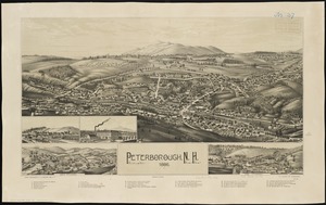
Peterborough, N.H : 1886
8084.
Peters World map
8085.
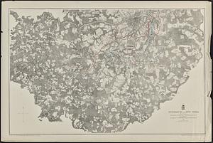
Petersburg and Five Forks
8086.
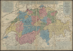
Petite carte de la Suisse pour les écoles = Karte von der Schweiz für schulen = Carta della Svizzera per le scuole
8087.
Petrocorii : Evesché de Sarlat : partie meridionale de l'eslection de Perigord
8088.
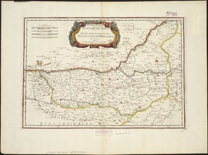
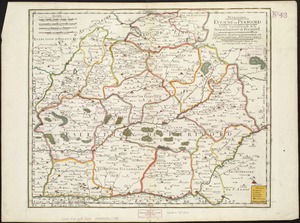
Petrocorii : Evesché de Perigord : partie septentrionale de la Seneschausée de Perigord : partie septentrionale de l'Election...
8089.
Phelps & Ensign's travellers' guide, and map of the United States, containing the roads, distances, steam boat and canal routes &c
8090.
Phelps & Ensign's travellers' guide, and map of the United States, containing the roads, distances, steam boat and canal routes &c
8091.
Phelps & Watson's new map of the United States
8092.
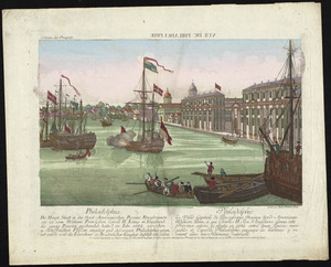
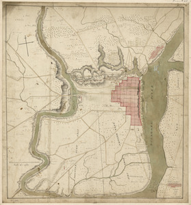
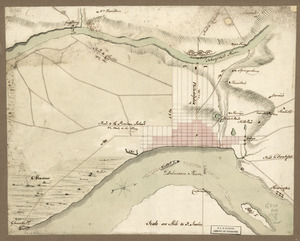
Philadelphia : dedicated to his excellency Sir Henry Clinton K.B. general and commander in chief of his majesty's forces,...
8093.
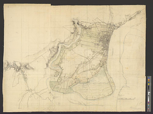
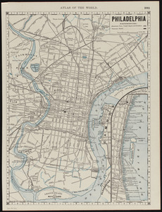
Philadelphia
8094.
Philadelphia
8095.
Philadelphia = : Philadelphie
8096.
Philadelphia and neighborhood
8097.
Philadelphia and vicinity. Military
8098.
Philadelphia water front, Schuylkill River, Pennsylvania
8099.
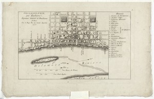
Philadelphie, par Easburn, arpenteur general de Pensilvanie
8100.
Philippine Islands : [outline map]
‹ Prev
Next ›
1
2
…
401
402
403
404
405
406
407
408
409
…
669
670