Toggle navigation
LMEC Home
Exhibitions
Georeferencing
Tools for Teachers
Collections
My Favorites
Sign Up / Log In
Search
Search the map portal
Map Collection
Map Collection
Map Sets
Search
Search
Search for
Search In
All Fields
Creator
Title
Subject
Place
Search All Digital Collections
Advanced Search
14021 Results
Filter your Search
Place
North and Central America
10,683
United States
8,692
Massachusetts
2,808
Suffolk (county)
1,682
Boston
1,638
Europe
1,420
Canada
1,009
New York
674
more
Place
»
Topic
Boston (Mass.)--Maps
748
City planning--Massachusetts--Boston--Maps
418
United States--History--Revolution, 1775-1783--Maps
331
United States--Maps
328
Real property--Massachusetts--Boston--Maps
254
Urban renewal--Massachusetts--Boston--Maps
254
North America--Maps--Early works to 1800
240
Massachusetts--Maps
234
more
Topic
»
Date
Date range begin
–
Date range end
Current results range from
1482
to
2023
View distribution
Creator
United States. Hydrographic Office
597
Boston Redevelopment Authority
404
Des Barres, Joseph F. W. (Joseph Frederick Wallet), 1722-1824
247
Jefferys, Thomas, -1771
172
Royal United Services Institute for Defence and Security Studies
160
George, III, King of Great Britain, 1738-1820
152
George, IV, King of Great Britain, 1762-1830
151
O.H. Bailey & Co
148
more
Creator
»
Format
Maps/Atlases
13,839
Manuscripts
985
Prints
102
Books
49
Drawings/Illustrations
44
Photographs
15
Objects/Artifacts
13
Documents
7
more
Format
»
Georeferenced
Yes
979
No
13,042
Collection
Norman B. Leventhal Map & Education Center Collection
9,110
American Revolutionary War-Era Maps
3,627
Boston and New England Maps
2,921
Urban Maps
2,480
Maritime Charts and Atlases
1,169
William L. Clements Library Collection
910
Library of Congress Collection
618
Boston Redevelopment Authority Collection
475
more
Collection
»
Available to use
No known restrictions
10,268
Creative Commons license
1,678
Search Constraints
Sort by relevance
relevance
title
date (asc)
date (desc)
Number of results to display per page
20 per page
10
per page
20
per page
50
per page
100
per page
View results as:
grid view
map view
Search Results
7981.
Noua orbis terrarum delineatio singulari ratione accommodata meridiano tabb. Rudolphi astronomicarum
7982.
Noua totius terrarum orbis geographica ac hydrographica tabula
7983.
Noua totius terrarum orbis geographica ac hydrographica tabula
7984.
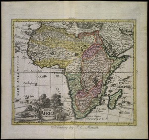
Nouae Africae delineatio
7985.
Noui Belgii Nouaeque Angliae nec non partis Virginiae tabula
7986.
Nouus planiglobii terrestris per utrumque polum conspectus
7987.
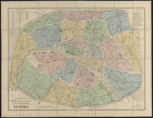
Le nouveau guide de l'étranger dans les 20 arrondissements de Paris
7988.
Le Nouveau Mexique et la Floride : tirées de diverses cartes, et relations
7989.
Nouveau Mexique, Louisiane, Canada, et les Etats Unis
7990.
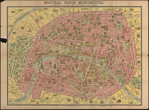
Nouveau Paris monumental : itinéraire pratique de l'etranger dans Paris
7991.
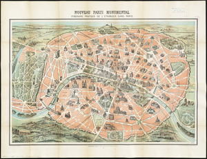
Nouveau Paris monumental : itinéraire pratique de l'étranger dans Paris
7992.
Nouveau plan de la ville de Génes : corrigé de tous les changemens faits jusqu'à ce jour, 1846
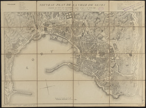
7993.
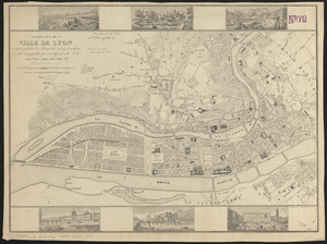
Nouveau plan de la ville de Lyon : où sont représentés les monuments anciens et modernes les plus remarquables qui...
7994.
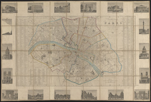
Nouveau plan de Paris divisé en 12 arrondissements
7995.
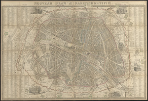
Nouveau plan de Paris fortifié
7996.
Nouveau plan de Paris ou guide des étrangers
7997.
Nouveau plan du Lac ontario depuis Le fort frontenac jusquà Chouayguin, avec les isles Et Bancs qui y Sont
7998.
Nouveau plan illustré de la ville de Paris : avec le système complet de ses fortifications et forts détachés, et des...
7999.
Nouveau plan illustré de la ville de Paris : avec le système complet de ses fortifications et forts détachés, et des...
8000.
Nouveau plan illustré de la ville de Paris avec le système complet de ses fortifications et forts détachés, et des communes...
‹ Prev
Next ›
1
2
…
396
397
398
399
400
401
402
403
404
…
701
702