Toggle navigation
LMEC Home
Exhibitions
Georeferencing
Tools for Teachers
Collections
My Favorites
Sign Up / Log In
Search
Search the map portal
Map Collection
Map Collection
Map Sets
Search
Search
Search for
Search In
All Fields
Creator
Title
Subject
Place
Search All Digital Collections
Advanced Search
107 Results
My Search
Start Over
Date
1940
to
1944
Remove constraint Date: <span class='from'>1940</span> to <span class='to'>1944</span>
Filter your Search
Place
North and Central America
51
United States
50
Asia
15
Massachusetts
15
World
14
Europe
12
Boston
9
Suffolk (county)
9
more
Place
»
Topic
United States--Maps
10
World maps
10
Fire risk assessment
8
Insurance surveys
8
Boston (Mass.)--Maps
6
Pictorial maps
6
World War, 1939-1945--Maps
5
Aeronautics
4
more
Topic
»
Date
1940
to
1944
[remove]
107
Date range begin
–
Date range end
Current results range from
1770
to
1999
1940
to
1940
31
1941
to
1941
24
1942
to
1942
40
1943
to
1943
34
1944
to
1944
41
Creator
United States. Office of Strategic Services. Geography Division
15
United States. Office of Strategic Services. Research and Analysis Branch
9
Associated Factory Mutual Fire Insurance Companies
7
Chase, Ernest Dudley, 1878-1966
7
Chase, Ernest Dudley, 1878-
5
United States. Office of Strategic Services. Reproduction Branch
4
Boston Elevated Railway Company
3
Bridge, Edward Melville, 1890-
3
more
Creator
»
Format
Maps/Atlases
105
Objects/Artifacts
1
Photographs
1
Prints
1
Georeferenced
Yes
5
No
102
Collection
Norman B. Leventhal Map & Education Center Collection
85
American Textile History Museum Image Collection
8
Boston and New England Maps
8
Lucius Beebe Memorial Library Historic Maps
5
Ralph Finos Map Collection at Phillips Academy
5
Urban Maps
5
David Judkins Weaver Papers
2
Massachusetts Real Estate Atlases
2
more
Collection
»
Available to use
No known restrictions
92
Creative Commons license
1
Search Constraints
Sort by relevance
relevance
title
date (asc)
date (desc)
Number of results to display per page
20 per page
10
per page
20
per page
50
per page
100
per page
View results as:
grid view
map view
Search Results
61.
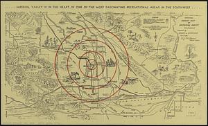
Official tourist map of Imperial County, California
62.
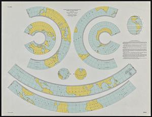
Outline maps for the construction of a model of the world, based on the Lambert conformal conic projection
63.
Patchogue-Plymouth Mills Corp., North Andover, Mass. [insurance map]
64.
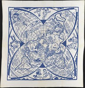
Peace map of the world united : a pictorial history of transportation and communications from Jonah to the jet plane as paths...
65.
Peoples of the Pacific
66.
Philippine Islands population, 1939 census
67.
Philippine Islands radio stations and cables
68.
A pictorial map of loveland
69.
A pictorial map of the United States
70.
Plan of Boston & Maine Railroad terminal division Boston, Cambridge, Somerville, Everett and Medford
71.
Plan of corner of Centry & Beacon St's -- 1741
72.
Plan of the burnt district : showing proposed improvements in streets. Nov. 12th 1872
73.
P.W.A. and industry : how benefits are spread
74.
Radiotelegraph and radiotelephone communication systems of France : radiotelegraph communication system of the French Ministry...
75.
Railroads of Lithuania, 1939
76.
Los recursos de los Estados Unidos
77.
Reg Manning's table-top argu-map of the world
78.
Roads and communications of Sinkiang
79.
Rural cultural regions in the United States
80.
Saishin ōshū daichizu
‹ Prev
Next ›
1
2
3
4
5
6
![Patchogue-Plymouth Mills Corp., North Andover, Mass. [insurance map]](https://bpldcassets.blob.core.windows.net/derivatives/images/commonwealth:ww72bz24s/image_thumbnail_300.jpg)