Toggle navigation
LMEC Home
Exhibitions
Georeferencing
Tools for Teachers
Collections
My Favorites
Sign Up / Log In
Search
Search the map portal
Map Collection
Map Collection
Map Sets
Search
Search
Search for
Search In
All Fields
Creator
Title
Subject
Place
Search All Digital Collections
Advanced Search
206 Results
My Search
Start Over
Ohio
Remove constraint Ohio
Filter your Search
Place
North and Central America
181
United States
122
Ohio
50
Ohio River
21
Pennsylvania
18
Allegheny (county)
10
Pittsburgh
10
Virginia
10
more
Place
»
Topic
Ohio--Maps
28
United States--Maps
10
Northeastern States--Maps--Early works to 1800
8
Ohio River Valley--Maps, Manuscript--Early works to 1800
8
North America--Maps--Early works to 1800
6
Ohio--Boundaries--Michigan--Maps
6
Pennsylvania--Maps
6
Railroads--Ohio--Maps
6
more
Topic
»
Date
Date range begin
–
Date range end
Current results range from
1753
to
1934
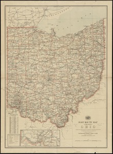
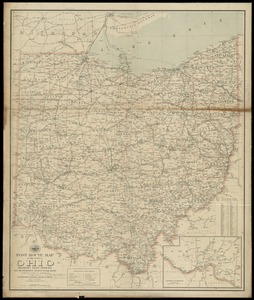
View distribution
Creator
Hutchins, Thomas, 1730-1789
15
United States. Post Office Dept
10
Amherst, Jeffery Amherst, Baron, 1717-1797
7
Evans, Lewis, 1700?-1756
7
Royal United Services Institute for Defence and Security Studies
7
Jefferys, Thomas, -1771
6
George, III, King of Great Britain, 1738-1820
5
George, IV, King of Great Britain, 1762-1830
5
more
Creator
»
Format
Maps/Atlases
204
Manuscripts
32
Prints
2
Drawings/Illustrations
1
Georeferenced
Yes
21
No
185
Collection
Norman B. Leventhal Map Center Collection
124
American Revolutionary War-Era Maps
94
William L. Clements Library Collection
30
British Library Collection
14
Richard H. Brown Revolutionary War Map Collection at Mount Vernon
13
Library of Congress Collection
12
Urban Maps
11
American Antiquarian Society Collection
5
more
Collection
»
Available to use
No known restrictions
126
Creative Commons license
42
Search Constraints
Sort by relevance
relevance
title
date (asc)
date (desc)
Number of results to display per page
20 per page
10
per page
20
per page
50
per page
100
per page
View results as:
grid view
map view
Search Results
61.
[Map of the Allegheny and Ohio Rivers] ; Franzosische see kusten von Provence zwischen Marseille und Toulon = : Cotes maritimes...
62.
Map, exhibiting the position of the several lines connected with the settlement of the Ohio boundary question
63.
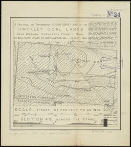
A geological and topographical rough survey map of the Hinckley Coal Lands near Warsaw, Coshocton County, Ohio
64.
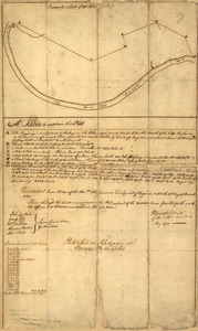
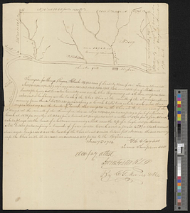
Surveyed for George Rogers Clark 36.962 acres of land...lying in Lincoln County and on the Ohio : June 7th, 1784
65.
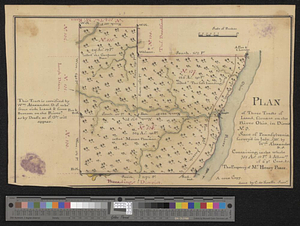
Plan of three tracts of land, situate on the river Ohio, in district no. 3. state of Pennsylvania : survey'd in July, 1785
66.
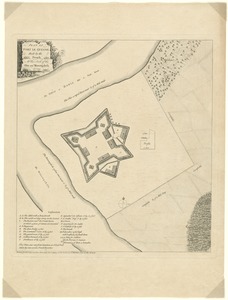
Plan of Fort le Quesne, built by the French at the fork of the Ohio and Monongahela in 1754
67.
Plan of Fort le Quesne, built by the French at the fork of the Ohio and Monongahela in 1754
68.
Plan of Fort le Quesne, built by the French at the fort of the Ohio and monongahela in 1754
69.
The rapids of the Ohio commonly called the falls 682 miles below Fort Pitt in 38 [degrees]; 08' no. latitude : by order of ye...
70.
A general map of the middle British colonies, in America; viz Virginia, Maryland, Delaware, Pensilvania, New-Jersey, New-York,...
71.
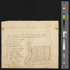
Plan of lands in the Ohio Companys purchase lying in sections no 1 & no 7 town no 2 range no 12
72.
Plat of a survey of 2,314 acres of land, being the first large bottom on the east side of the Ohio River : 3 or 4 miles below...
73.
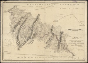
Map of the country between Washington & Pittsburg refering to the contemplated Chesapeake & Ohio Canal and its general route...
74.
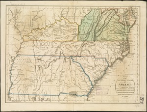
Map of the southern states of America, comprehending Maryland, Virginia, Kentucky, Territory s'th of the Ohio, North Carolina,...
75.
North America from the French of Mr. D'Anville, improved with the back settlements of Virginia and course of Ohio, illustrated...
76.
North America from the French of Mr. D'Anville, improved with the back settlements of Virginia and course of Ohio, illustrated...
77.
Western route, from Boston to Michigan, Ohio and Indiana ; Southern route, from Boston to Wilmington and Red Clay ; S. Western...
78.
Post route map of the state of Ohio showing post offices with the intermediate distances on mail routes in operation on the...
79.
Post route map of the state of Ohio showing post offices with the intermediate distances on mail routes in operation on the 1st...
80.
A map of Potomack and James rivers in North America shewing their several communications with the navigable waters of the new...
‹ Prev
Next ›
1
2
3
4
5
6
7
8
…
10
11
![[Map of the Allegheny and Ohio Rivers] ; Franzosische see kusten von Provence zwischen Marseille und Toulon =](https://bpldcassets.blob.core.windows.net/derivatives/images/commonwealth:z603vr31n/image_thumbnail_300.jpg)


![The rapids of the Ohio commonly called the falls 682 miles below Fort Pitt in 38 [degrees]; 08' no. latitude](https://bpldcassets.blob.core.windows.net/derivatives/metadata/commonwealth-oai:3x81bj69w/image_thumbnail_300.jpg)